Ghost Hunt - Felsenland-Sagen-Weg 2023
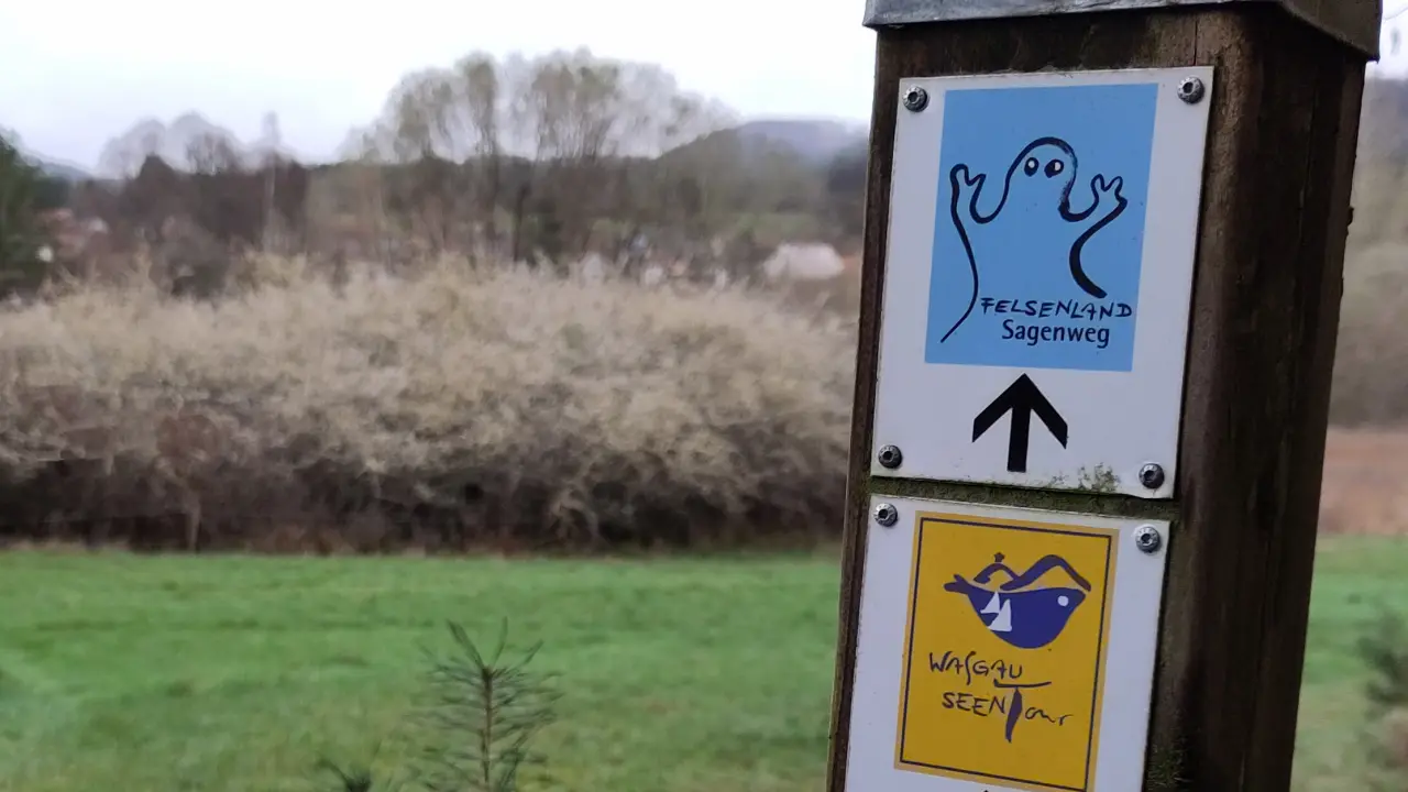
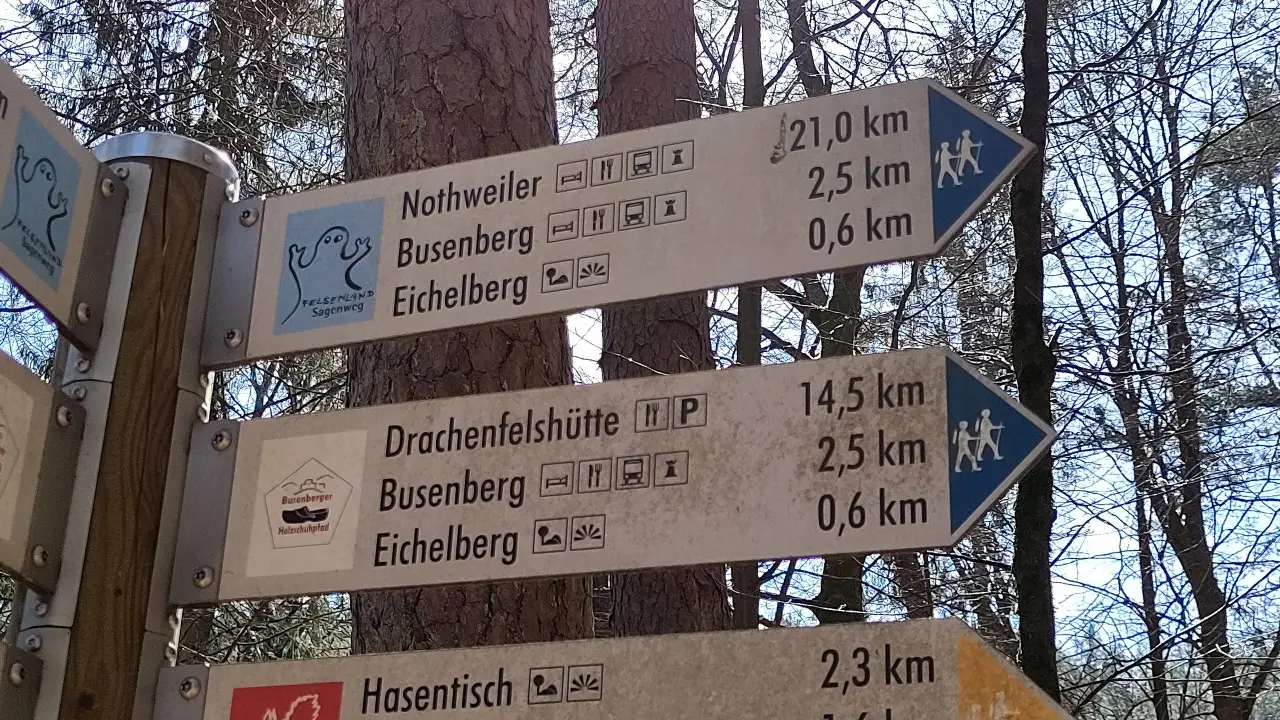
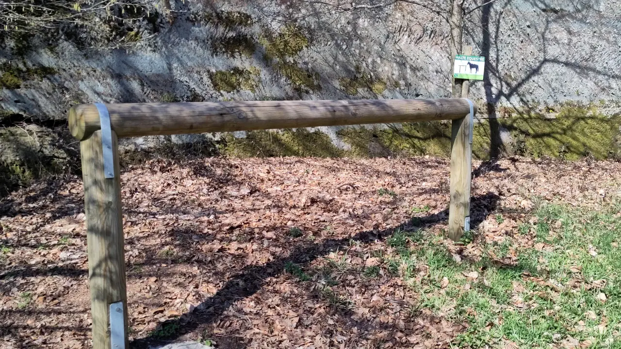
After the Heat Battle 2022 we definitely went outside the summer months this time. In April we headed to the French border to the Dahner Felsenland in the Palatinate Forest. To make travel much easier, we once again planned a roundtrip. This time, we chose the Felsenland Sagenweg, which follows winding paths from Dahn to behind the French border in the south and back again. The trail is very well-marked: every few meters, a little ghost shows you the way. So reliably, in fact, that after just a few meters without a sign, we became suspicious, only to realize that we had missed a turn. Definitely a recommendation for the operators of other hiking trails to take a note from this one.
Contents
- Contents
- Arrival
- Day 1 - To Dahn!
- Day 2 - Rocks and castles
- Day 3 - Did I here someone giggle?
- Day 4 - Cross-border travels and an accommodation disaster
- Day 5 - Another quick trip to France and back to the start
- Departure and conclusion
Arrival
This time we traveled by car. At 430 km, it’s not exactly around the corner, but significantly faster than by train (not to mention the cost, especially with the 9-Euro-Ticket no longer available). Once again, it worked out with Lütti and us, so we were able to pick her up on the way in Mannheim. For logistical reasons (the car needed somewhere to park for a week), our hike didn’t start in Dahn, but in Ludwigswinkel. We planned to spend the first night, before setting off in the morning.
Even though our accommodation, the Rösselquelle, is a hotel and restaurant, we had to find somewhere else to eat that evening. We were told the restaurant is closed out of season. Luckily Ludwigswinkel offers another place to eat, the Gasthaus zum Landgrafen. There, we could stuff ourselves with cheese spaetzle until we were about to burst. Lovely. So good, in fact, that we immediately reserved a table for our last evening after the hike.
Day 1 - To Dahn!
If we're in the Dahner Felsenland, we probably should stop by the eponymous town. Technically the trail starts and ends in Dahn (I think directly at the main municipal administrative building of the Dahner Felsenland, but I'm not sure about this). We just started in Ludwigswinkel because it would have been way more complicated to get rid of our car in Dahn. Our hike was basically shifted by one stop with regards to the standard trail.
The day started with a good breakfast in the hotel's restaurant (which was open for breakfast, just not dinner). The usual buffet. What wasn't usual were the breakfast eggs. Well, the eggs themselves were standard chicken eggs, but raw. The hotel had a rather creative solution for the problem, that different people like their eggs differently. I, for example, am partial to soft eggs with rather liquid yolk. Manu is definitely not a fan. As most people seem to be able to agree on hard-boiled eggs, that's what hotels usually offer. Not the Rösselquelle in Ludwigswinkel: the eggs are uncooked and there is a big cooker full of water with fitting egg holders to hang the eggs into the container. You put an egg into the holder, hang it into the boiling water and get your perfect breakfast egg (assuming you get the timing right, which did work surprisingly well based on the given instructions). Technically a perfect idea. It just would've been nice to add a small sign to the egg basket informing people about the raw eggs. Nobody did crack one of those, but some people were stopped just in time from taking a raw egg to the table.
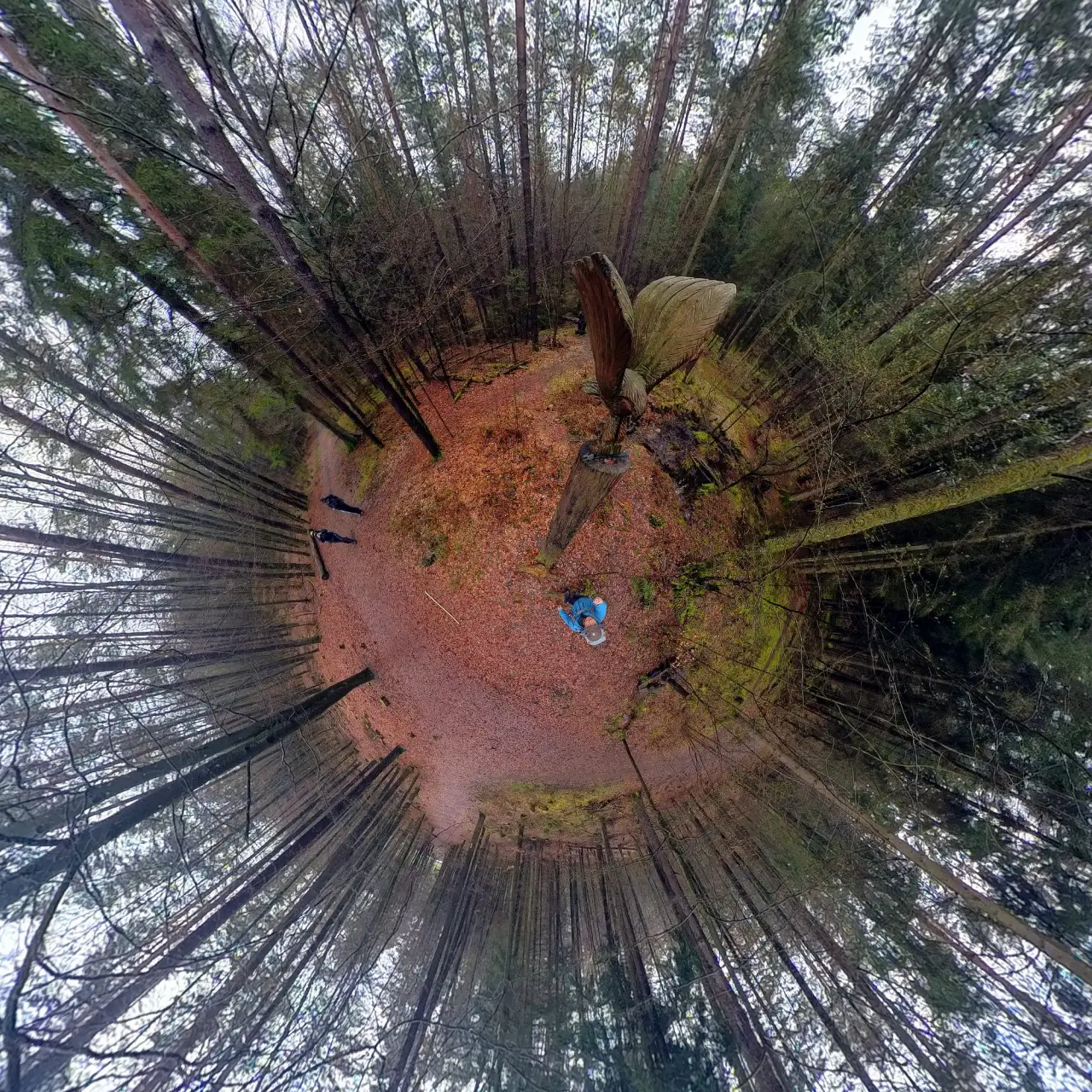
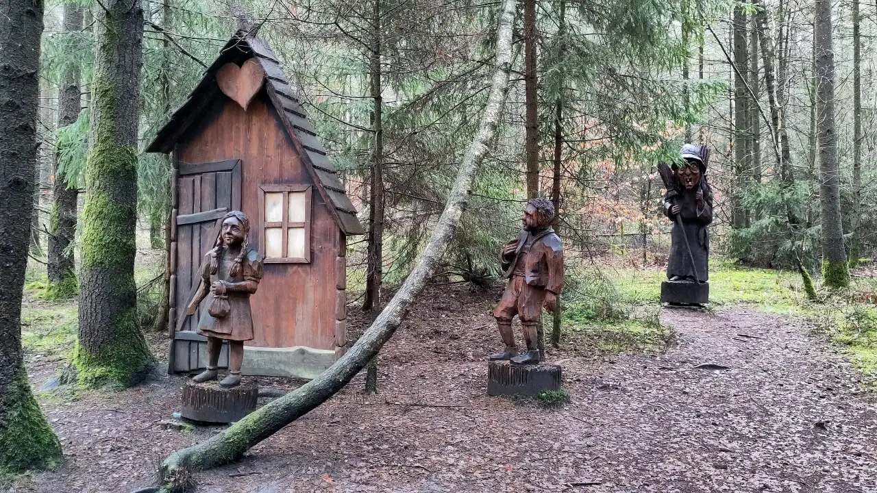
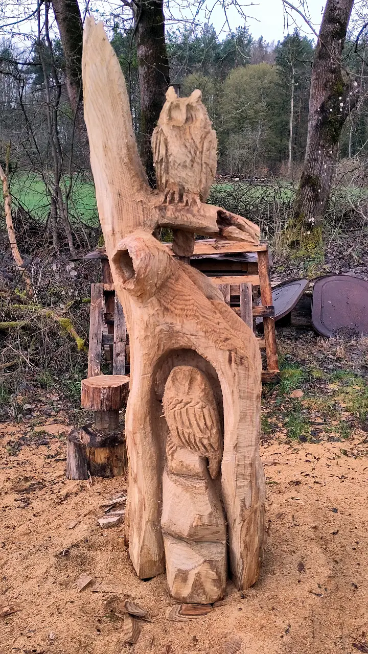
After that we started with a relaxing little walk through the park in Ludwigswinkel and a small cult(o)ur(e) through the adjecent woods. One of the forest tracks has a whole bunch of carved wooden statues from different fairytails and legends (Sagenweg = trail of legends) next to it. Not necessarily something you would drive to the Palatinate Forest for, but a nice distraction on a hike.
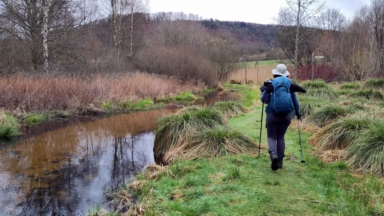
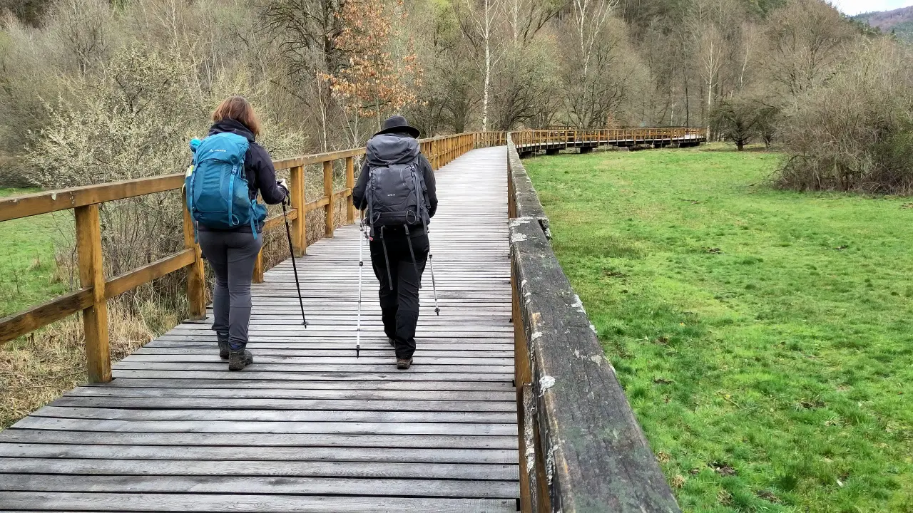
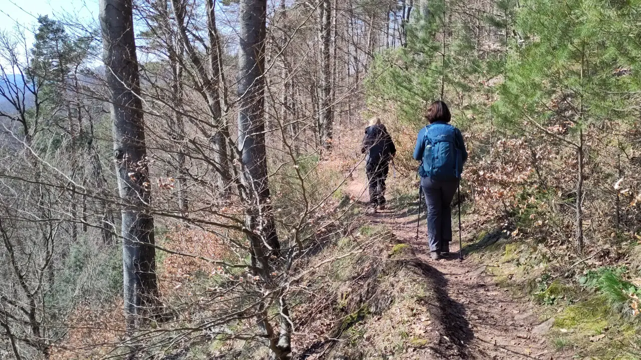
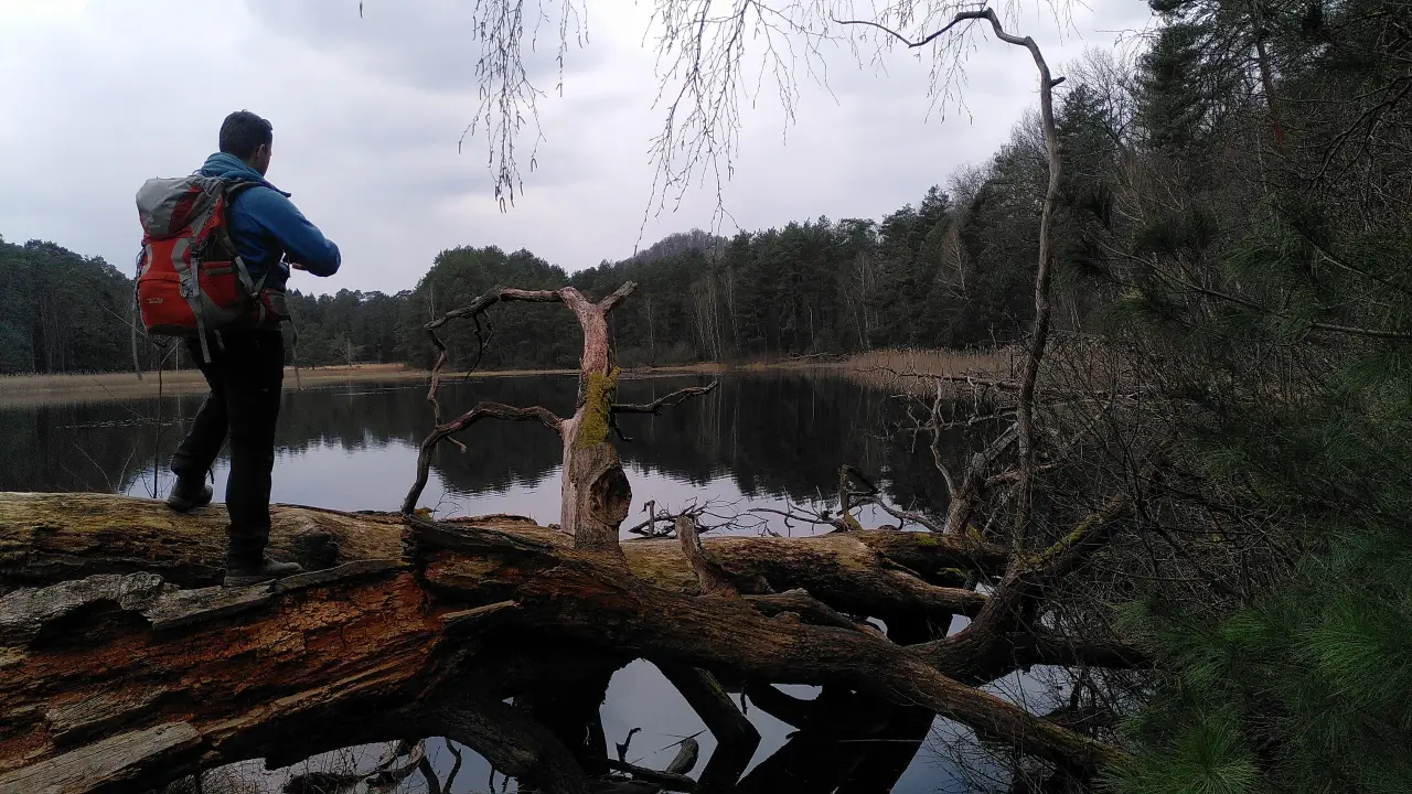
After this short diversion the trail continues through meadows and woods, passing impressive sand stone rocks from time to time. The Dahner Felsenland (rock country) does earn its name. The name of the game for the day was "water", though. Not so much from above (we were lucky in that regard), but on and in the ground. Hiking tracks are especially beautiful, when they are little cross-country trails. The Sagenweg definitely spoils hikers with that. When the last few days where very rainy, though, little cross country trails quickly become mud pits. Nothing impossible to cross, but very dirty at times. The most critical parts of the trail (which probably flood from time to time) were build on wooden bridges, but for the rest of the track: keep your eyes open and get on with it!
The day went from Ludwigswinkel via Fischbach bei Dahn and Rumbach to Bruchweiler-Bärenbach. Along the way we went past the workshop of the artist creating those sculptures from the beginning of the day (at least that's what we presume). Somewhere in the woods north of Rumbach we stumbled upon a... let's call it an "outdoor workshop", i.e. a clearing with a big mess of tools, half-finished sculptures and various bits and bobs, where some kind of owl sculpture was in the making. Nobody was working that day, but the half-finished owl was a clear clue.
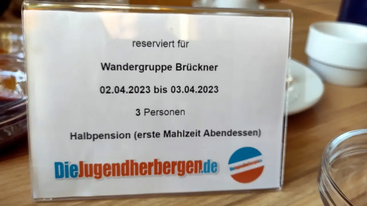
We did plan from the start to take the train from Bruchweiler-Bärenbach to Dahn. The total distance on that day would've been too much otherwise and we didn't want to shoot our last bolt on the first day already. It's just two stops, but the Deutsche Bahn actually forced us to commit fare evasion (I wonder whether this offense already lapsed... 🤔). It was simply impossible to by tickets at the station or the train. Before someone shouts "DB Navigator!" from the sidelines: thanks to the glorious coverage by o2 (which would become relevant more than once in the coming days), the app also didn't work. In the end we did hope, that we either wouldn't be checked (which is how it happened) or we could argue our problem in the train. Two short stops later at Dahn Süd, we could get on with the last hill for the day. Since our Harz tour 2020 we're members of the Deutsches Jugendherbergswerk (the German youth hostel association), which we needed to stay in Torfhaus back then. As per usual, we forgot to cancel the membership. We didn't get a chance to use it in 2021 and 2022, but this year the stars aligned: the Felsenland-Jugendherberge a bit above the town center is a rather old building (I couldn't find out how old, but I did find post cards from 1935), that still has the original youth hostel charm. If you're interested in the most modern equipment, maybe look somewhere else. If you're just looking for a cozy place to stay for the night, you're in the right place, though. We were told that a big renovation would be coming up "soon". Whether this is already finished, we obviously don't know. We did like it, though. The food was good and our (typical for the first day) tired legs had cozy bunk beds to rest in.
Day 2 - Rocks and castles
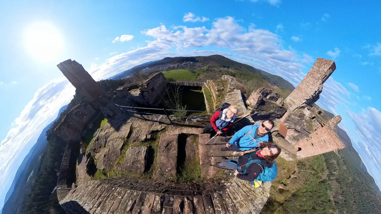
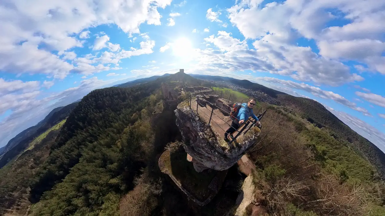
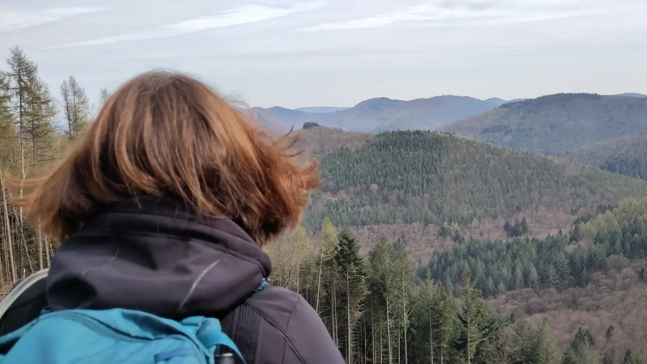
The second day gave us rocks and castles to our hearts' content. The Dahner Felsenland has been situated at the border of various countries over the centuries and is therefore (and due to its jagged geography) home to a large number of old castle ruins. Some are mere pieces of wall or holes in rocks, other still seriously impressive (and actually lived in sometimes). We had two (well, technically four) in our plans for the day: Neudahn Castle and the Castles of Dahn (Tanstein, Grafendahn and Altdahn. More on that alter), both rather impressive ruins in the area around Dahn. The trail takes a big loop from Dahn to the north-west, turns around at Neudahn castle, crossing Dahn towards Erfweiler.
The first rocks of the day were directly next to the youth hostel. There are two rock pillars named "Bride and Bridegroom" directly next to the hostel and a few meters away you'll find the "Wachtfelsen" ("watch rock". "Watch as in "guarding something"). The latter gives the hostel its address and gets its name from a legend from the 30 years war. According to legend, the troups of the emperor had to retreat in a hurry, when the swedish troops approached suddenly. One soldies, who was standing guard on the rock, was forgotten in all that trouble. When his relief didn't come for quite some time, he climbed down into the village, saw what happened and suddenly didn't want to be a soldier anymore (understandably. As a soldier behind enemy lines in the 30 years war he'd possibly been executed. The Hague Conventions of 1899 and 1907 and the Geneva Conventions, that would've granted him protection, were a few centuries in the future). The local mayor hired him as a farm hand, he fell in love with (and married) the mayor's daughter and lived a rather uneventful live without the constant stresses of war. Many years later, peace having been brokered a long time ago, his old unit came back to the area, he (again) wasn't really keen on being executed, this time for desertion, so he put on his old uniform, took up his post on the rock and probably complained loudly, that his relief took so long. He was commended for his dilligence, left the army with full honors and returned to his peaceful life. How he survived for so many years in isolation on the rock and how he suddenly acquired a family and job, are questions everbody thought better not to ask, I guess. The commander of his unit probably turned all available blind eyes. Since that time the rock supposedly has the name refering to the guard. It can be climbed and is just a few minutes away from the hostel. We skipped it, though. We did have the whole day ahead of us anyway.
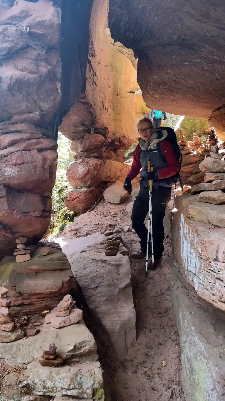
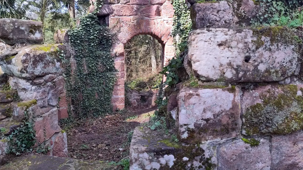
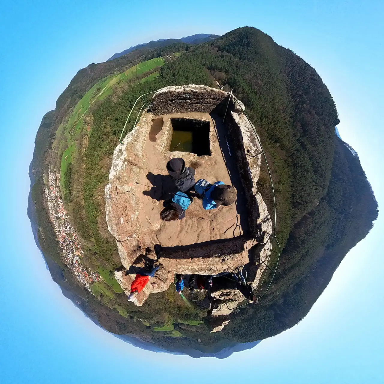
The hike started towards the Dahner Hütte, a shelter of the Pfälzerwald-Vereins (an association for the promotion of tourism in the Palatinate Forests). It was just a waypoint for us, but apparently you can get snacks there and there's a kid's playground and some info boards about wolfs and lynxes, that are native to the area again. From there we continued through the idyllic Moosbach valley, reaching the Dahner Felsentor at lunch time. Bring-along lunch, mind you. There is no infrastructure there. Just a big rock with a hole beneath Neudahn castle. Through the millenia, the elements carved holes into the rock, one big enough for the trail to pass through on its way up to Neudahn castle.
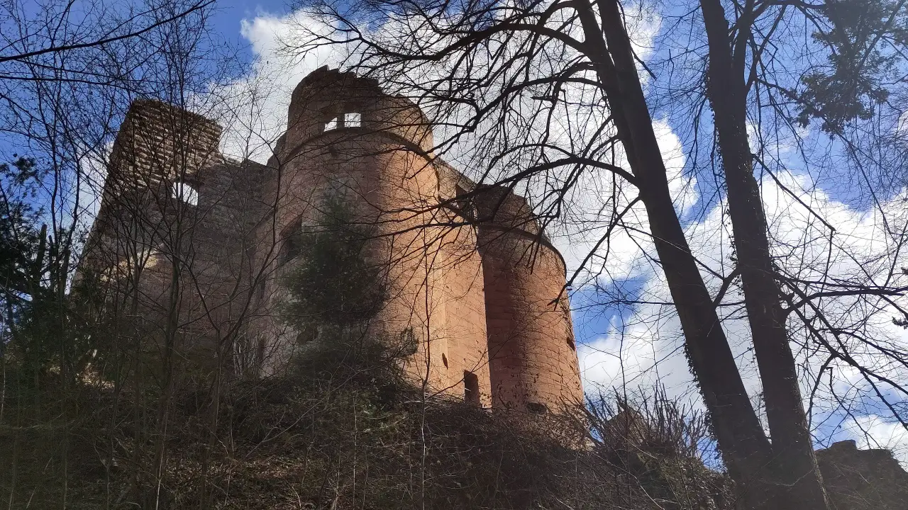
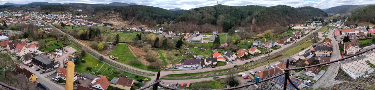
The castle ruin sits high above the confluence of Moosbach and Wieslauter. In its current form it was built in the 16th century, but the site actually stretches back further into the 13th century. According to Wikipedia it's one of the best preserved ruins in the souther Palatinate Forest (a very specific group of ruins, I think). I would go so far as to say it's just missing a bit of paint and you're good to go, but at least the castle has recognizable towers you can climb, dark cellars to explore and a few remaining door and window frames. That is more than some other ruins have going for them.
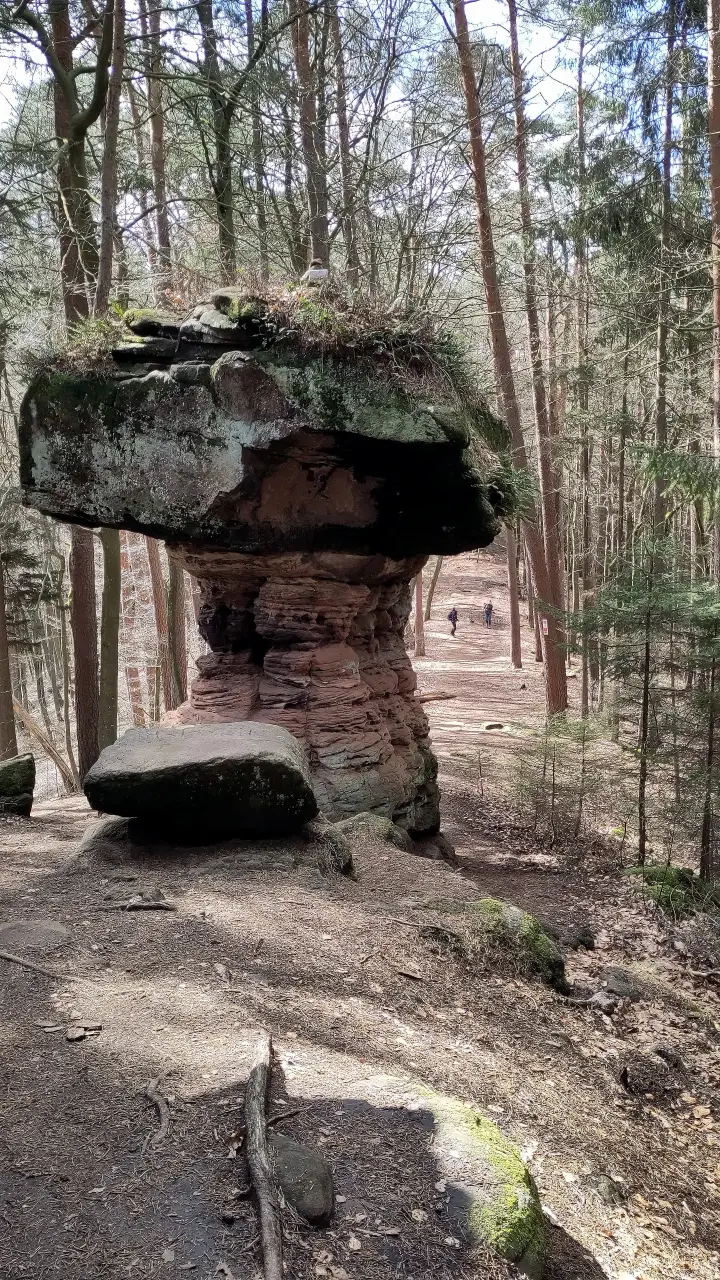
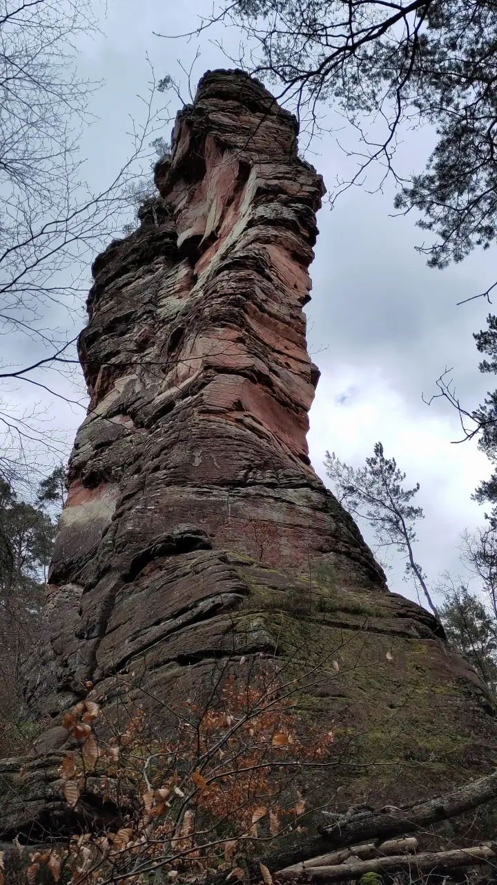
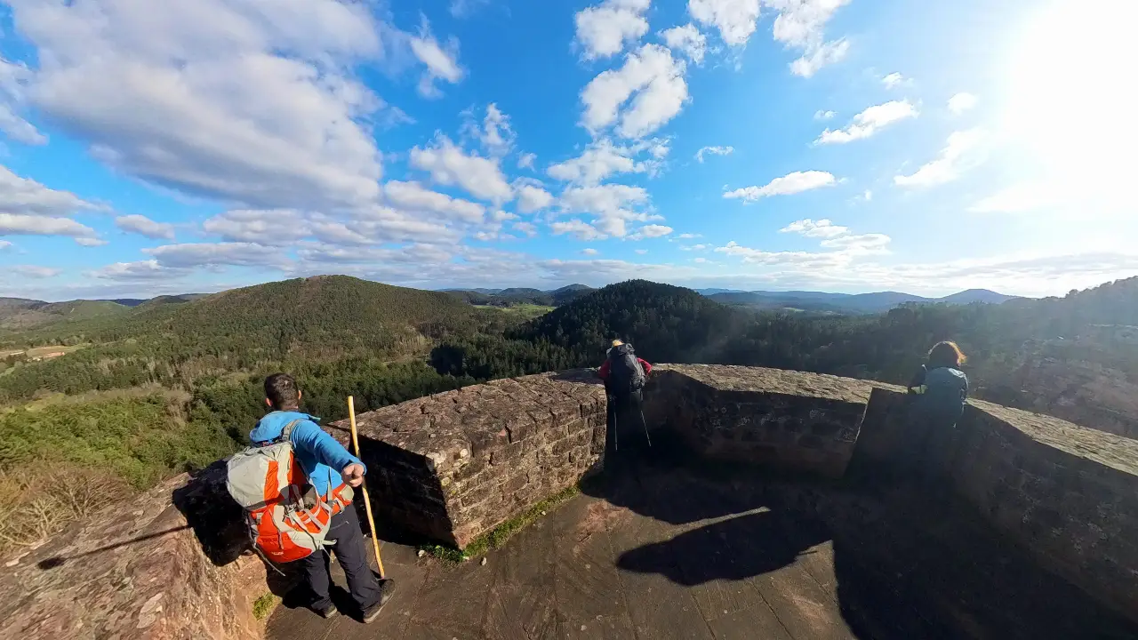
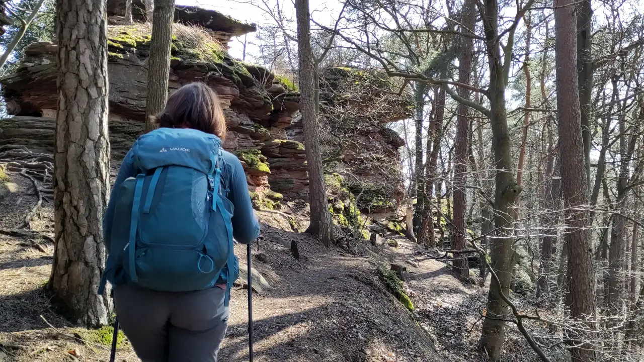
Leaving the castle we turned back towards Dahn to the Sängerfelsen (singer's rock. I don't know either.). This outcrop is at the Dahn end of the same ridge as the castle and overlooks the whole city (well, at least the parts that don't hide behind the next ridge already. The area is rather ... undulating, shall we say?). Along the way the woods hide different rock formations for which the area is famous: as the sandstone in the ground has varying hardness, it forms all sorts of interesting structures through erosion. Needles, tables/mushrooms, pillars, steep cliffs, arches, something for everyone.
Next order of business (as it would be quite often): down and up again. We wanted to get to the Jungfernsprung (maiden's jump) to have a look at the valley from the other side, before continuing further north. A short stop in a nice café, filling up our provisions in the local supermarket and on towards the Vogelsberg and Jungfernsprung.
According to legend, the Jungfernsprung gets its name (like so many times in those cases) from a damsel in distress (a virgin damsel, to be precise. Very important!). Why people in the olden days (or even today sometimes, for that matter) are so interested in the sex life of young women will forever be a mystery to me. In this specific case the virgin (again: important! Her name isn't recorded, by the way...) was walking in the woods, when she came upon a lecherous fiend (depending on the version anonymous or Hans Trapp), who wanted to "rob her of her innocence". In her distress she jumped off the rock (after senselessly fleeing in the wrong direction) and (again, depending on the version) is saved by her billowing dress or carried down by angels. Purity saved, rock got its name, everything's fine and dandy.
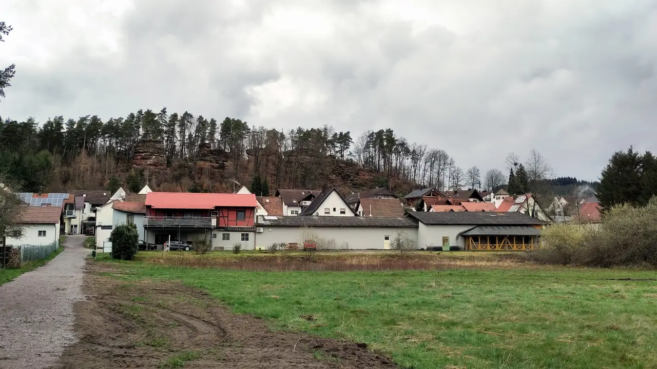
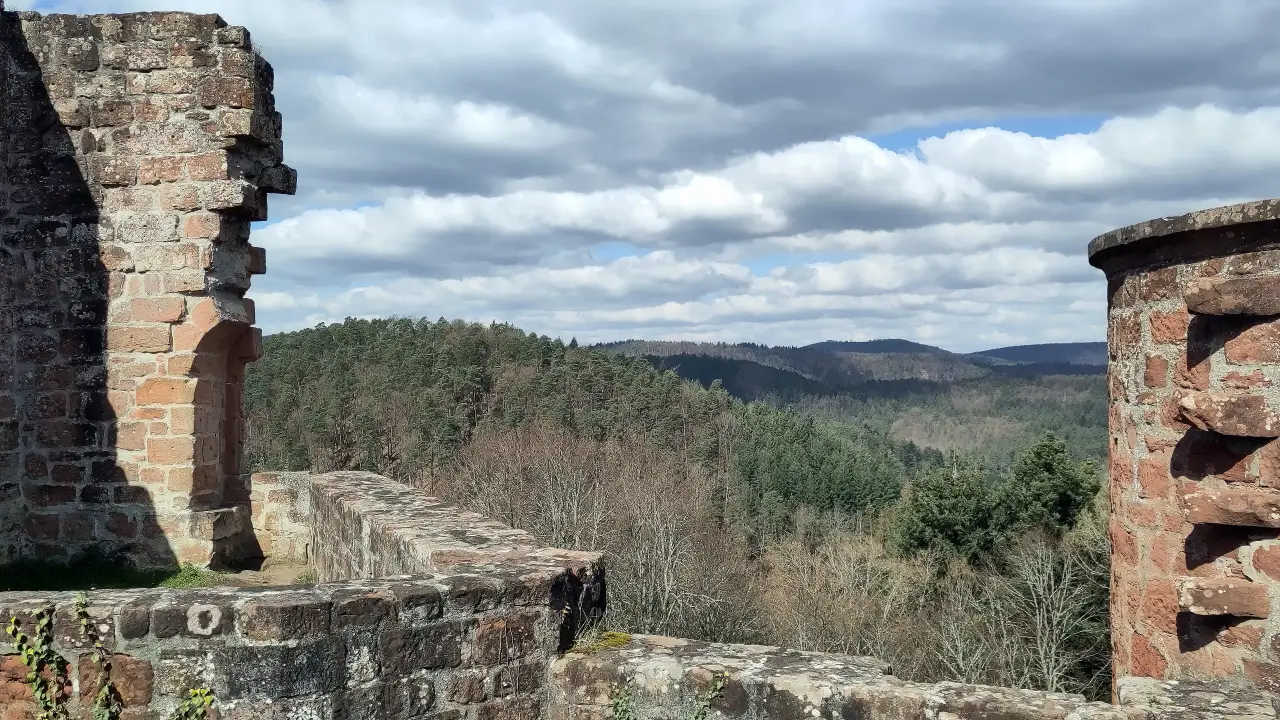
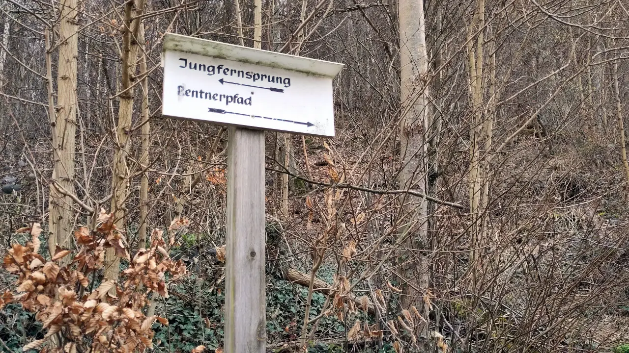
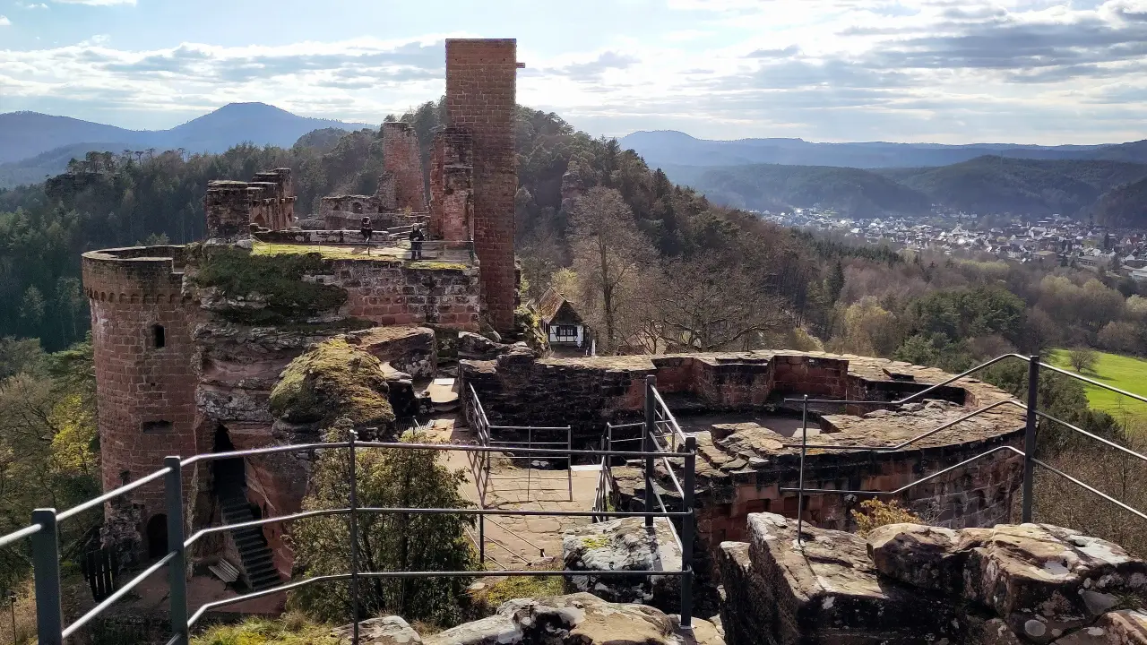
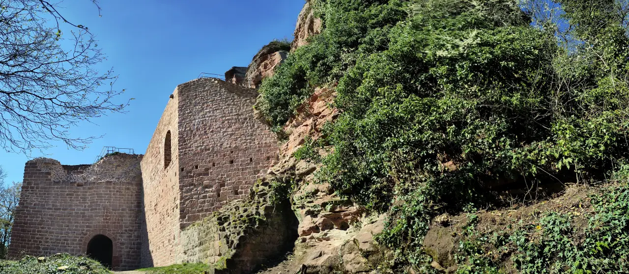
Back down the ridge towards the town center (past the cemetary, where, again, I'm not kidding, the pensioner's path ends), we continued on towards the north east. Our target for the day was Erfweiler, but before we wanted to take a look at one of the most impressive castles of the Felsenland: the ruins of the Castles of Dahn:Tanstein, Grafendahn und Altdahn. THese three share a ridge between Dahn and Erfweiler and represent different stages of settlement. Classic case of "the old built crap, I'll do my own thing!". Tanstein is the oldest of the bunch and dates to the 12th century. The next (or probably more next-next-next) generation decided to build a new castle at the northern end of the same ridge, confusingly named "Altdahn" (old Dahn) about 100 years later at the start of the 13th century. Apparently they didn't get it right either, because their descendants at the end of the 13th century again decided to build something new, filling in the gap between the two existing castles with Grafendahn castle. In addition to those just a few kilometers away Neudahn (new Dahn. It's all very confusing...) was built (which is probably newer than Altdahn (old Dahn), but older than Grafendahn). Busy people... Why they built so many castles in such a short time in the same area isn't recorded (at least not in the history presented at the castles). Today all three castles form a museum and can be explored at your own pace. You should bring some time, though (more than we did). The area is massive and offers a lot of rooms and nooks and crannies to explore.
Sadly we arrived shortly before the castles closed for the night, so that we just had a about an hour to explore the area. Afterwards we quickly decended towards Erfweiler to Hahnfels Pension, our accommodation for the night. The guesthouse was newly opened and therefore had all the modern bells and whistles you'd hope for. We slept very well (although, to be fair: we'd probably slep well under a bridge after one of those hiking days).
Day 3 - Did I here someone giggle?
Yes, yes, let's get the things for the inner twelve-year old out of the way:
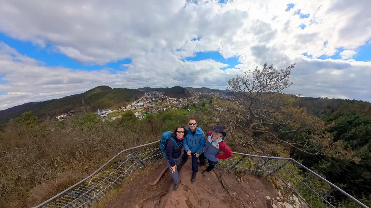
After getting this out of our systems: beyond the reach of Dahn, the third day was way less urban (although only a small part of the way went through the actual town the day before). The first part of the hike climbed steadly towards the Wasgaublick. One of those small rock outcrops in the woods that offer a beautiful view over the surrounding landscape. Along the way we had another nice view at the three castles from the day before, this time side-on. In a way this was the opposite to the view from the ramparts from the day before.
Another interesting observation of the (rather cold) morning: the Palatinate Forest apparently is the area where the holding patterns for some airport are flown (not exactly sure, which. Frankfurt seems to be a bit too far away. Maybe Mannheim?). This was clearly visible in the patterns on the frosty morning sky.
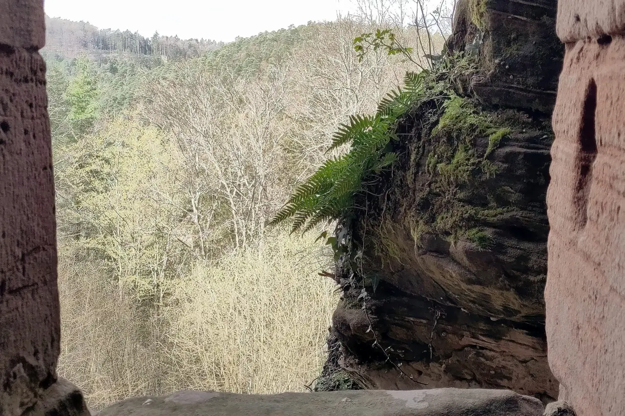
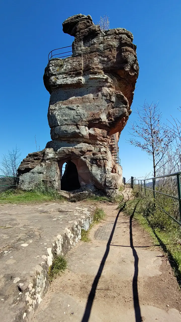
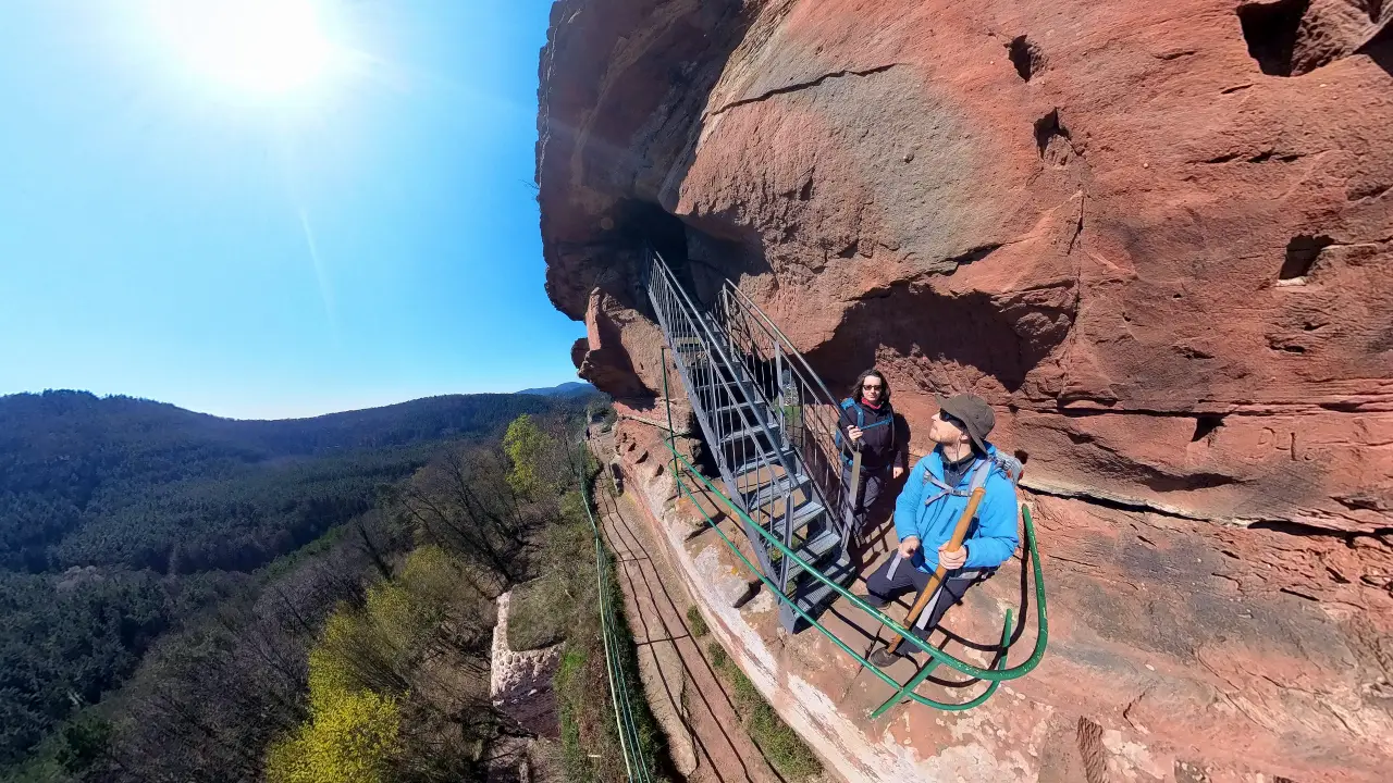
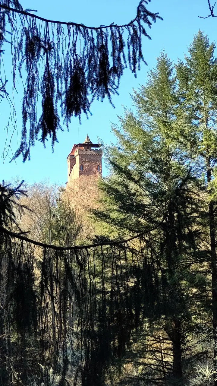
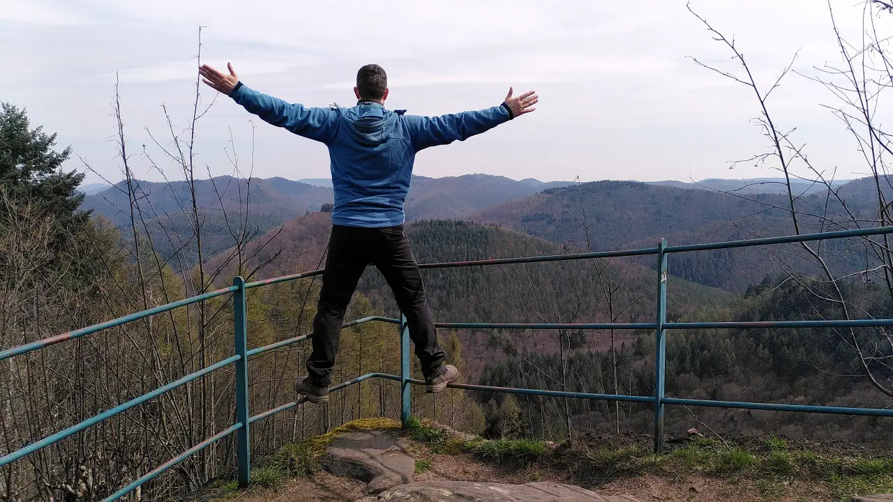
Our first waypoint for the day was Drachenfels Castle. This is a ruined hill castle and the name already tells it all: the whole castle is an interesting combination of a tall rock needle with cut in rooms and walkways, and some purpose-built stone walls to create even more room. The castle must have been even more impressive in earlier times, as it was destroyed completely already in the 16th century and subsequently used as a quarry for some bigger local projects. What is still around is impressive enough and offers a spectecular view of the surrounding area (including, to the endless delight of my inner twelve-year old, Busenberg, the rather nice village of about 1,000 people we passed along the way. There the manor house and the church were built from stone quarried in the castle).
After descending from Drachenfels we continued along narrow paths, past water buffalos (the things you find in the Palatinate Forest) towards the next castle: Berwartstein Castle. As a huge exception to all the others, this one is inhabited. It's no longer in its original state, by a long shot, though. Originally a hill castle like its neighbors, it fell in to ruin and was bought in the 19th century by some guy who just wanted to live in a castle. He didn't want to rebuild the original hill castle though, but rather live in his personal image of a castle. Hence the castle looks very different today, than it would have looked like when it was been used as a military installation. Today the castle is part private residence, part restaurant, museum, event location, guesthouse (they offer a few rooms), everything rolled up into one. We treated ourselves to some tart flambée before continuing.
A few more kilometers across the hills we ended our day in Bundenthal. We had an apartment for the night, that was a stark difference to the very modern guesthouse the day before: located in the upper floor of a detached house from (I'm guessing) the 60s in the outskirts of the village, it was quite obviously the living quarters of the grandparents of the family before. We were greeted by a rather grumpy dog, that wouldn't let us through to the doorbell at first. Yeah... In the end the owner were friendly though and we could take possession of the apartment. We had to haul our tired bodies down the hill again to get something to eat that evening. Gasthaus Krone didn't have rooms for us this day, but the food was great anyway. As per usual after a rather strenuous day we retired early and slept like stones. 60s feeling or not.
Day 4 - Cross-border travels and an accommodation disaster
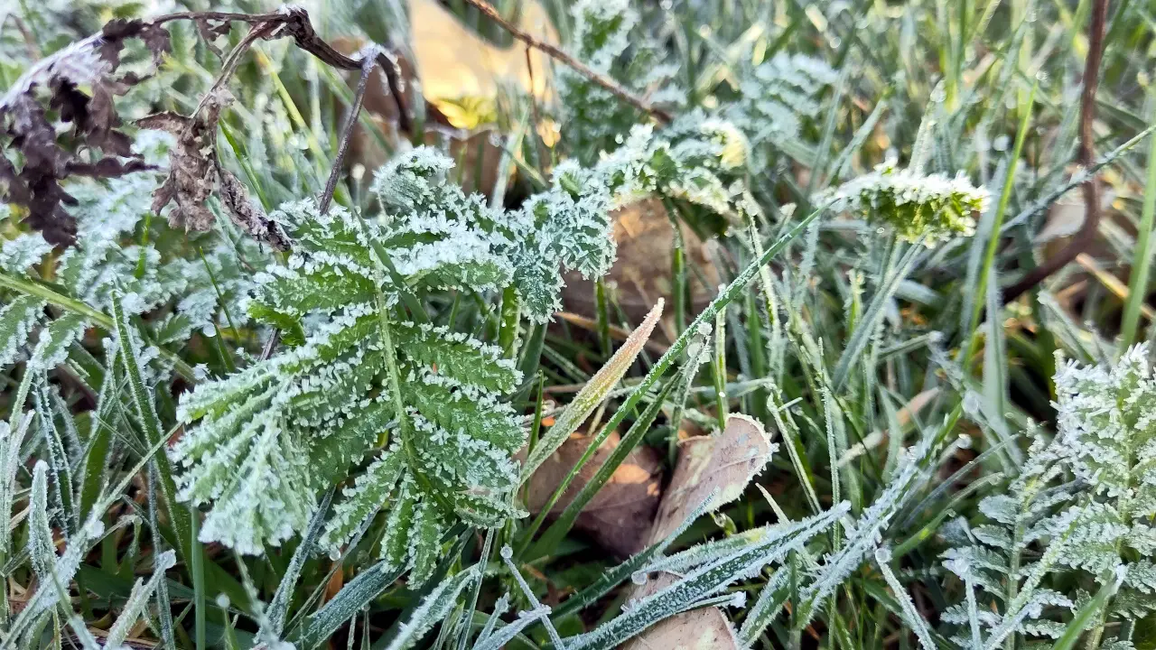
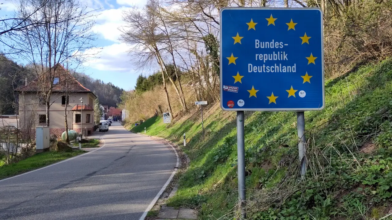
Our next day started with freezing temparatures (again). We picked up a few things from the local bakery and had breakfast at the bus stop (for the seats. We didn't want to take the bus) and then headed for France. Yes, France. The Palatinate Forest is located on the french border and seamlessly transitions into the Vosges Mountains. Through the centuries the area switched sides of the border multiple times (or rather switched the principality it belonged to). You can still see this in the place names, but more on that later. Thanks to the European Union (or more precisely the Schengen treaty) the border is of no interest today and the trail officially leads through France. It's basically impossible to spot, which country you're in, in the woods anyway, until you see some sign that does have a different language.
We started uphill towards Bundenthal Rumbach airfield (in memory of the year before)
Los ging es erstmal bergauf zum Flugplatz Bundenthal Rumbach (in Erinnerung an das Jahr zuvor, although we didn't have to cross the runway this time). The trail led (as it usually did) through narrow paths far from civilization (although you can see it in the valleys). Our first stop for the day was - surprise! - a ruined castle, the Wegelnburg. At a short rest along the way we met a couple, that was doing the same trail as we did. We had met the days before and chatted a bit about our plans, what we had experienced so far and where we'd stay. This would become extremly important for us later...
The Wegelnburg sits now and back then at the border and has a counterpart on the other side in the form of Château du Hohenbourg. Time for us to cross the french border then. The actual border is a saddle between two hills and is basically invisible. No landmarks, no signs, nothing. Suddenly you're in France. I like it. The Hohenbourg and its direct neighbor, Löwenstein Die Wegelnburg steht damals, wie heute an einer Grenze und hat auf der anderen Seite ein Gegenstück in Form des Château du Hohenbourg. Es war also Zeit, die französische Grenze zu überqueren. Der Übergang ist ein Sattel zwischen zwei Bergen im Wald und überhaupt nicht als solcher erkennbar. Keine Grenzsteine, keine Schilder, gar nichts. Plötzlich ist man in Frankreich. Ich mag das. Die Hohenburg und ihre direkte Nachbarin, die Château de Lœwenstein are just ruins (as most of them are), but offer (again: as most of them do) spectecular views into the distance (over the Vosges mountains, although this is just a matter of naming. They look the same as the Palatinate Forest)
You can see it in the names: this was all the same country before. OK, there's "Château de..." today, but the names are distinctly German. The Alsace did change hands quite a lot and the sharp language barrier just starts when modern nation states emerge. The trail continues in the same idyllic fashion on the french side. Narrow paths through the woods, distant views, rocks, and now and then (OK, once) a climber...
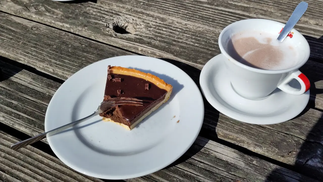
Our way constantly got us downhill to the next stop for the day with the glorious name Châtau Fort de Fleckstein (or Château de Fleckestein). Again an old castles that secured one of the little principalities. There are a few impressive parts of the old castle still left, our interest in ruins had already been met that day. We focused on the local café instead. Luckily for us the lady behind the counter spoke perfect German. As we had discovered during a short chat (or attempt thereof) in the woods some time before: drop us somewhere in France and we won't even find the train station 😅. Thanks to the lovely lady we could order coffee, hot chocolate, and a divine chocolate tarte without issue. I even got my walking stick brought to the table, when I left it - for the first, and, so far only, time - at the counter. A quiet afternoon in the sun in a Café in the french Vosges Mountains, after having hiked there on foot from Germany... I can't imagine many nicer things.
The day wasn't supposed to end in France though, so we needed to tear ourselves away at some point and press on. The way continued just as idyllic as before, until it meets the road a short way before Hirschthal. There you can clearly see the german border. No immigration, no border control, but a big sign.
The rest of the way meandered along the Saarbach from Hirschthal to Schönau, where we had booked a hotel room for the night. The hotel (I'm quiet about which one exactly for reasons that will become obvious in a second) had a sign at the door with the request to please call a phone number. So far nothing unusual. Outside of the season a few accommodations don't have permanent staff available, so you have to call someone to open the doors. Unfortunately, Schönau doesn't have any o2 coverage, but the neighboring restaurant was nice enough to let us use their phone.
The call must be one of the most memorable, that Manu (in italic) has ever had (I shortend the actual call, keeping the meaning):
"Hello! We booked a room and are now standing in front of the hotel."
"Good evening. We're closed."
"Yes, we saw the sign on the door. That's why we're calling, as the sign said."
"Erm... No, we're closed till the beginning of May." (Note: it was April 5th)
"... Eh... Come again? We have a booking confirmation and everything."
"Oh, the boss made a mistake then. We're closed the whole winter until May."
"Eh... And where are we supposed to sleep tonight?"
"I'm sorry. I can give you a few alternatives..." (starts rattling off alternatives that are all more than 20 km away)
"We're on foot..."
"..."
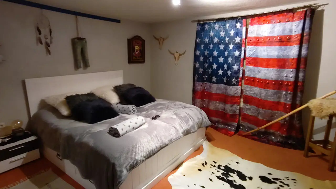
We genuinly felt sorry for the employee, that had to cover for her chaotic boss (not for the first time, as we would learn later), who's apparently staying somewhere in the south during winter. Problem for us though: a predicted 2°C at night definitely would require some kind accommodation, which isn't easy to come by outside the season, basically without any advance warning. Luckily for us we had met that couple that day. They told us that they hadn't gotten anything in the hotel (guess why...) and therefore had instead booked the slightly more expensive Longhorn Ranch in the neighboring village. We quickly looked up their phone number in the restaurant and gave them a call. The owner was nice enough to prepare a room for us for the night. They usually don't rent out most of their rooms for one night only (just because of the effort required), but after having heard our story, she was very understanding.
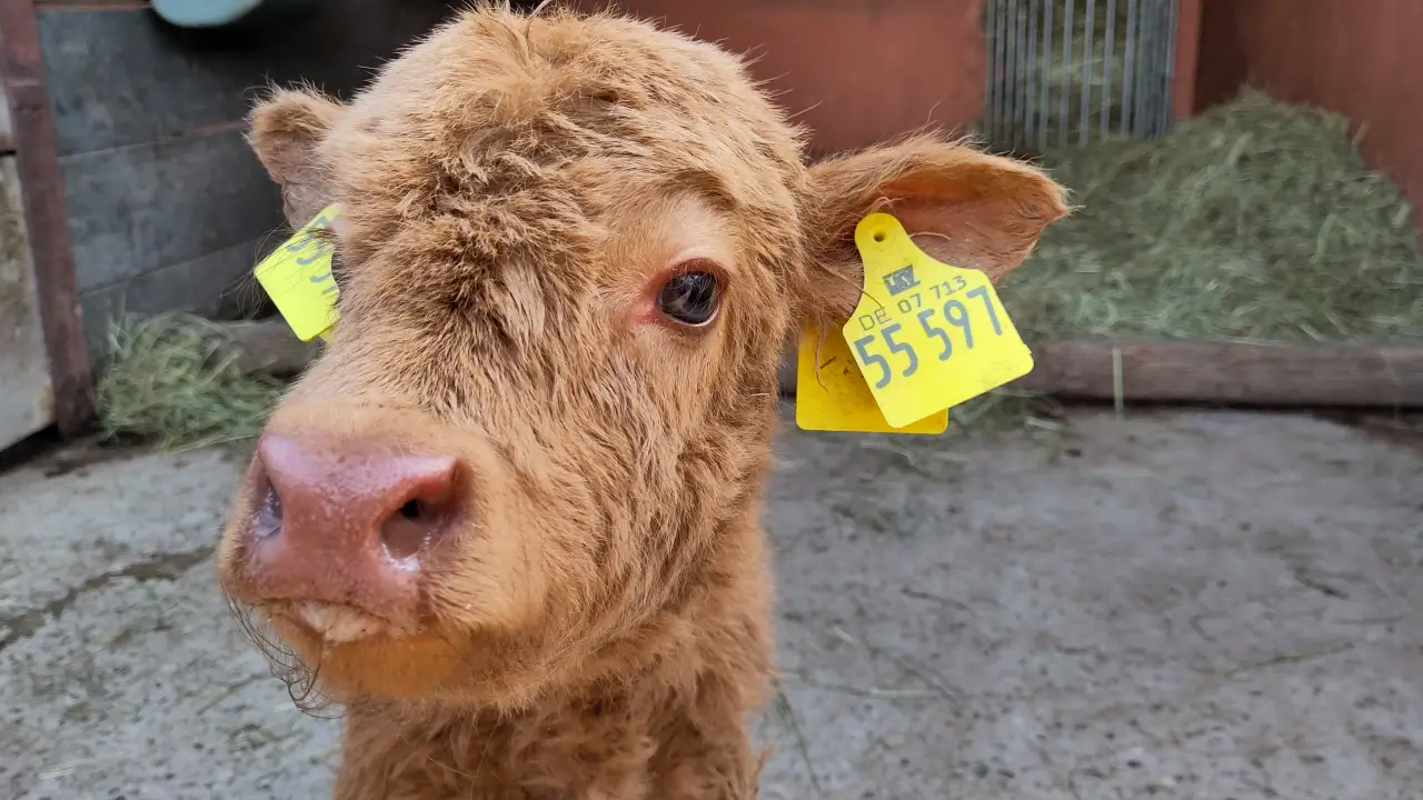
A nice meal in the restaurant later and we had to start on the last (unplanned) part of our journey for that day. Due to the local geography and the way the forest tracks run, it was our turn to be the idiots to walk along the road in the dark without lights. Luckily the road was rather lonely, so we got to Gebüg without any incident. Our hosts greeted us with an apology: "I could only make some makeshift preparations for the room because we had a new calf and have to feed it, because the mother cow doesn't accept it". If that's "makeshift", I don't know what could've been improved. We were more than happy and sat outside around the campfire with the owners and talked late into the night. This is how a disaster turned into a very nice experience for us.
There was an epilogue to the whole situation: I read up on my legal rights as a guest in this kind of situation. I couldn't believe that a hotel could just leave you standing there. Turns out: they can't. You can look for a comparable accommodation and bill the original one with the price difference. As the Longhorn Ranch was slightly more expensive than the original hotel, that's exactly what I did. They never sent a reply. Instead, come the beginning of May I got the billed amount sent to my bank account. Someone knew they were wrong, it seems. A little "sorry" by the boss would've been appropriate though...
Day 5 - Another quick trip to France and back to the start
The next day would already be our last. After a very good breakfast (where we had to explain to our surprised acquaintances from the day before, why we were suddenly there), we got the bill this time. Normally I don't really care, but this time I had a hunch, that this would come in handy. The owner fully understood and basically insisted on me taking the bill with me. After that we had a quick look at the newborn calf. It did survive the night (probably mostly due to the owners getting up every two hours and feeding it). Our motto for the morning was "To France!" (again). Starting in Gebug, we started to climb the Maimont, a twin peak sitting right across the border. The mountain saw a small, but costly battle at the start of the western campaign in WWII. Germany back then even got soldiers in from Austria, because they were afraid afraid, that the locals wouldn't want to shoot their neighbors. Apparently they were well aware just how stupid those arbitrary borders were in everday life of the locals and were concerned, that whatever "loyalty" they had would go the "wrong" way. The battle is remembered with the Peace Cross today, a memorial, that was built in the 50s to commemorate the fallen.
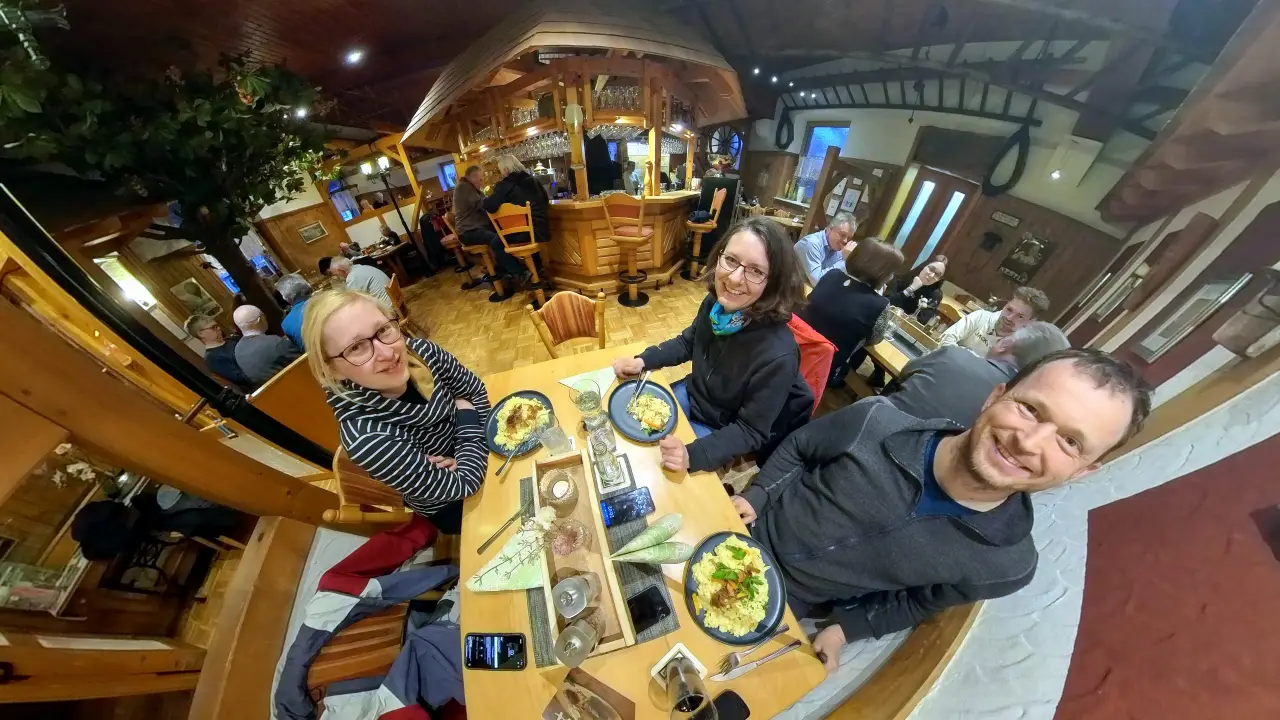
From the Maimont we followed the steep serpentines along the border back down towards Petersbächl, where Manu found the Café Schokolädl (sorry, they just have a german Facebook site). After the full frontal chocolate assault we wanted some more. This little café is in the ground floor of what looks like a normal detached house serves all kinds of home-made. There we were questioned extensively by the family on the neighboring table (OK, mainly the mother). She was very curious what we were up to (our hiking gear apparently had aroused her curiousity). She was very keen on knowing how all the long distance hiking works and basically wanted to start of on a multi-day hike immediately (her husband look way less keen). After we replenished our energy reserves and successfully sold hiking as a hobby, we started the last segment of our hike (well, more like a last little stroll) back to Ludwigswinkel to the starting point of our hike. A little tour past the Pfälzerwoog (a little marsh) and back we were to the start. We had booked a table for the last evening, so we went to the only restaurant at the place to celebrate the last evening with a good portion of spaetzle.
Departure and conclusion
We had planned one last overnight stay, because driving a few hours just isn't any fun after a day of hiking. This way we could start the trip relaxed the next morning after enjoying a bit of the sun. Drop Lütti off in Mannheim at the train station, pick up the kid at the grandparents and back home.
What to say about the Felsenland Sagenweg? Definitely a recommendation for a long-distance hike. So far we consider it to be the most beautiful after the Coast to Coast (which is kind of in a category of its own anyway due to the sheer distance and, therefore, variety). The "quality trail" rating is definitely well earned. The absolute majority of the trail comprises narrow winding paths far from civilization. The rocks provide interesting view (if you can get up them). Hiking outside the season has its pros and cons: accommodations are potentially easier to get because they are not already fully booked. They can be completely closed, though (although that technically shouldn't happen). Some things might have reduced opening hours or be closed completely, although that isn't strictly relevant when hiking. The fact, that you switch between Germany and France without even noticing the border is fascinating to me. And you really can build too many castles...