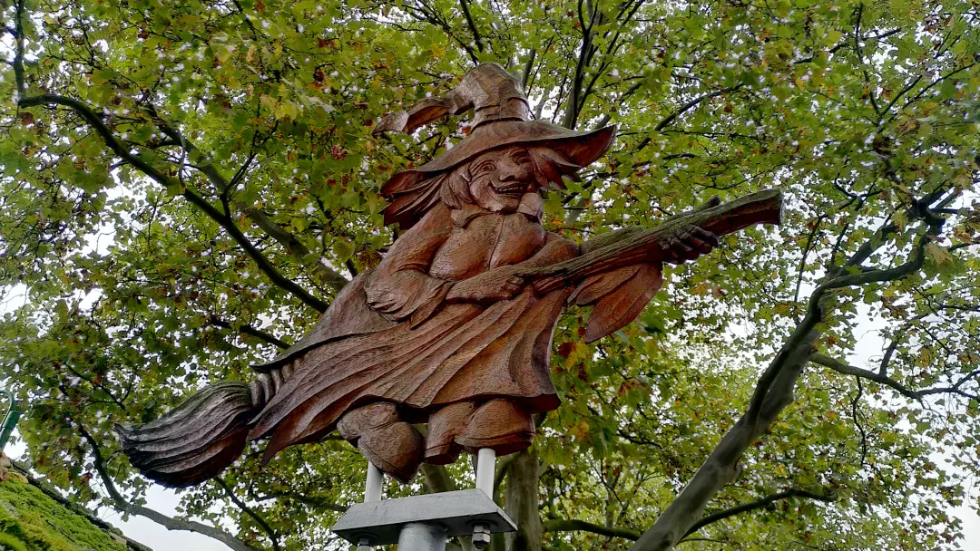
The call of the witch! - The Harzer Hexenstieg
Our second long-distance hike! Woohoo, the Coast to Coast Walk didn't scare Manu away, quite the opposite. She got a taste for it and set her sights on the Harzer Hexenstieg. Originally we planned to tackle it as a trio, but our dear Lütti had to cancel at the last minute. So, just the two of us...
Contents
- Contents
- Day 0 - First: Getting There
- Day 1 - What a Mudfest
- Day 2 - Being young again
- Day 3 - Shut the door! It's drafty in here!
- Day 4 - Water, lots of Water...
- Day 5 - Impressive Infrastructure and Daredevils Galore
- Day 6 - Sprint to the Finish Line
- Epilogue
Day 0 - First: Getting There
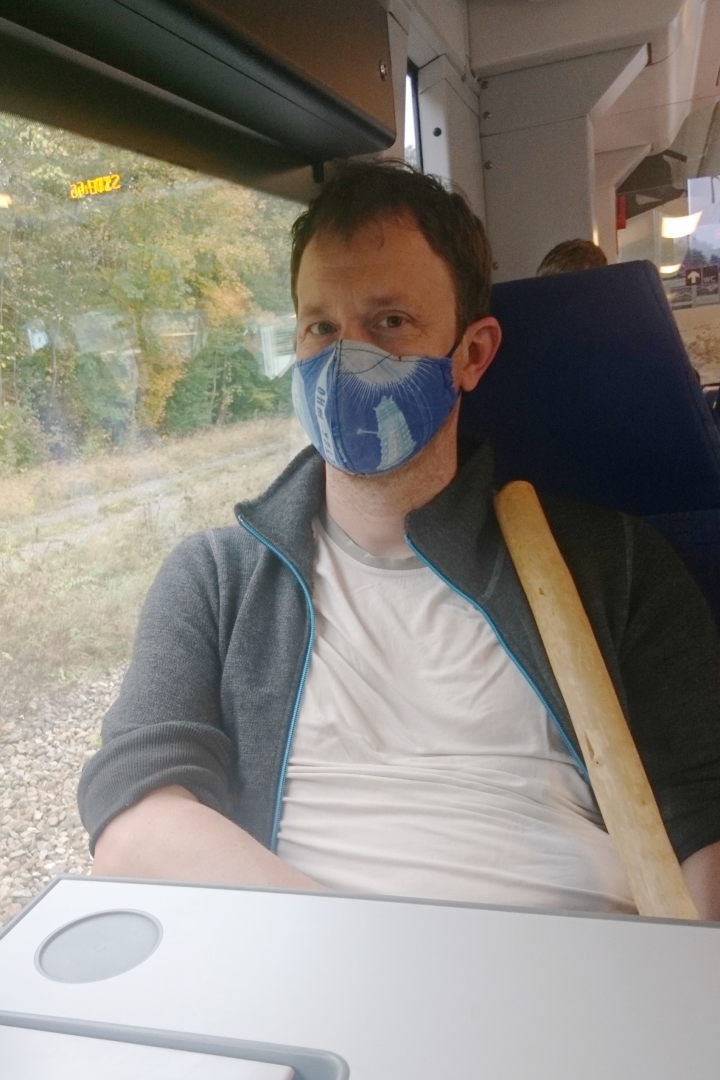
So, there we were on an October morning at our train station, ready to take the train to Osterode. In the meantime, this pesky little pandemic had caught up with us, so we spent over 4 hours wearing masks on regional trains.
Markus with a mask on a regional train
In the end, we made it and arrived at Osterode station in the afternoon. Deutsche Bahn was delighted that we left them some money instead of bringing our own transportation.
We had booked a hotel for the night. Very quiet, being so far out of the season. The only problem: there was no dinner available at the hotel restaurant during the off-season. So, we ventured into the (very limited) "nightlife," which basically meant going to the nearest kebab shop. What an experience: they had just put a fresh meat skewer on, so it took quite a while for the meat to be ready. At the same time, a bunch of people showed up all at once. Along with the COVID distancing rules, a pretty impressive line formed in front of the shop, where people surprisingly had a good chat while waiting. After a good 45 minutes, we finally walked away with our pretty tasty kebabs. That was the highlight of the evening. So, we went to bed early, as the next day was the start of our hike.
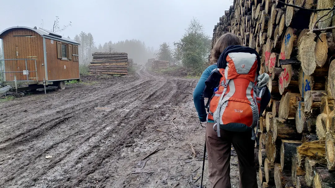
Day 1 - What a Mudfest
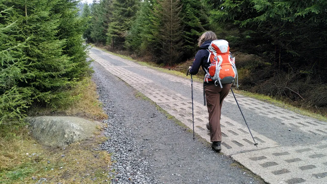
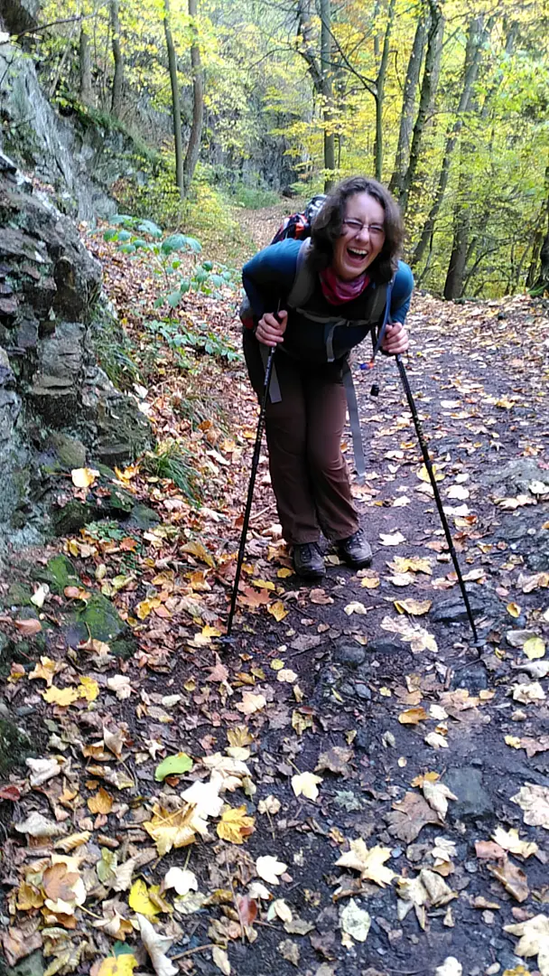
Next morning: a delicious breakfast and off we went. There was one important difference from our hike in England: back then, we could leave part of our luggage at the accommodation every morning, and, magically, it would end up at the next place by the end of the day. But this time we had to carry everything ourselves. We had planned for this, of course, and tried to pack our backpacks lightly. About 8 kilos per person, which would later prove to still be a bit too much.
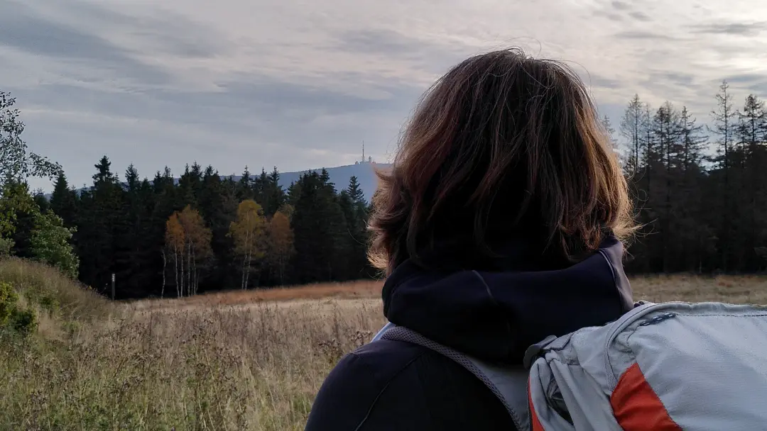
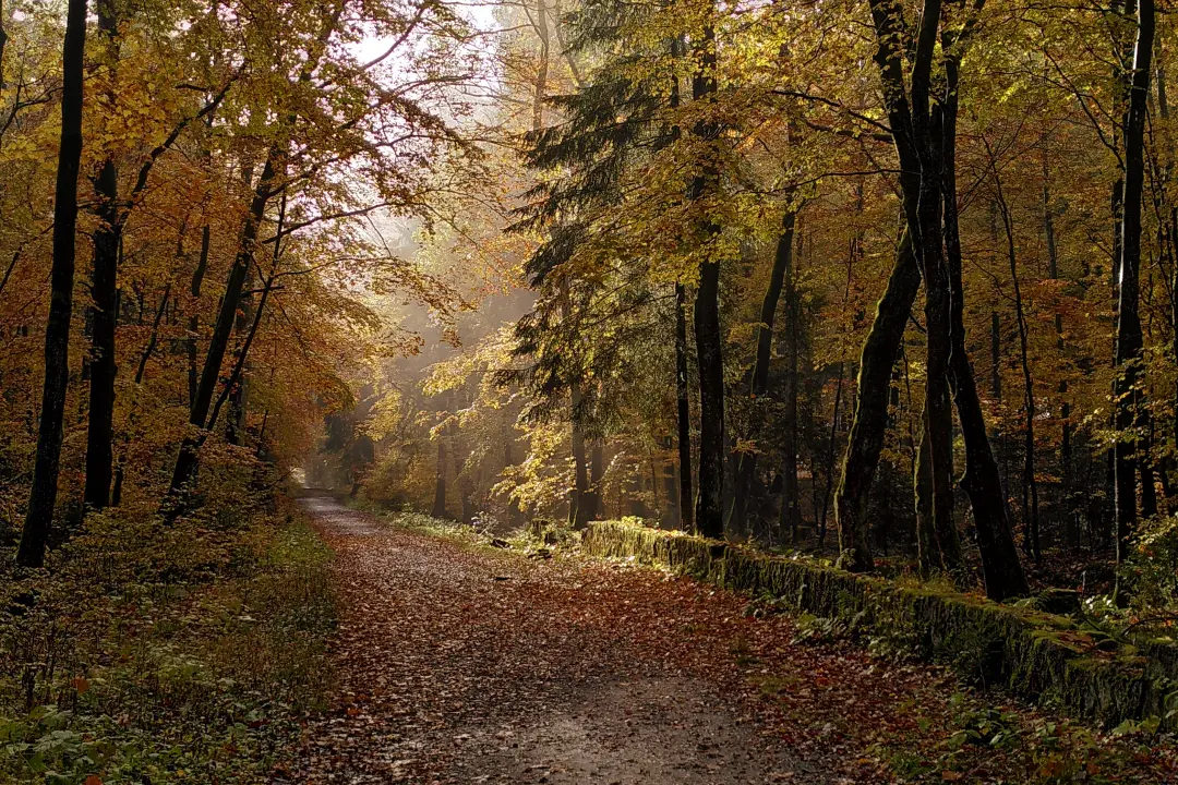
The weather had turned autumnally cool. The mountains were still shrouded in fog as we strolled through Osterode to the trailhead before heading up the mountain.
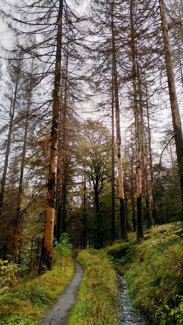
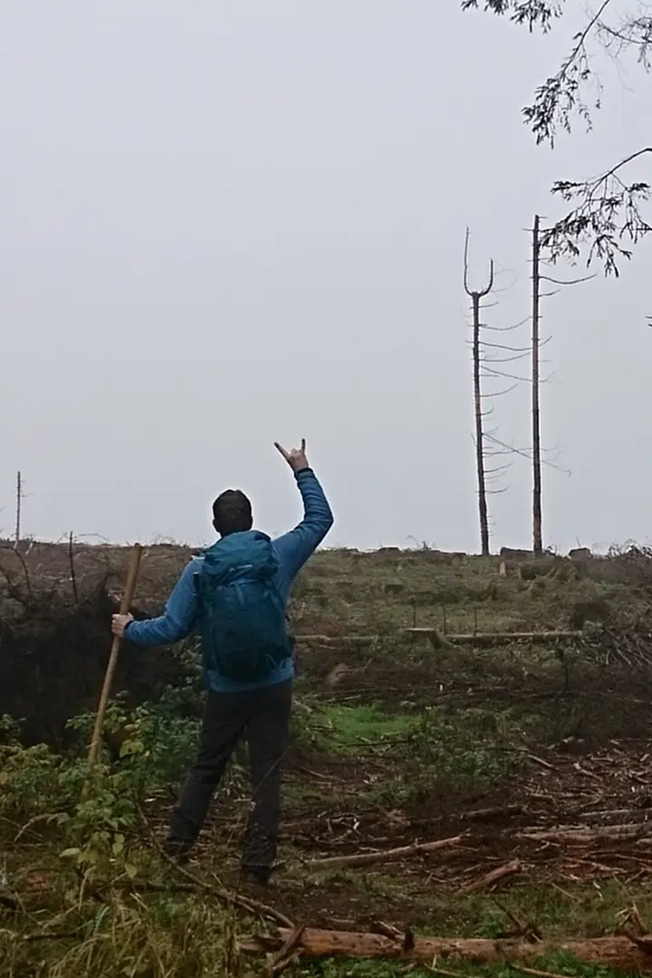
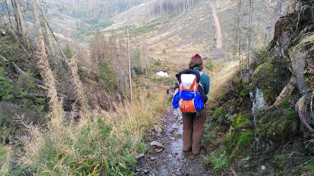
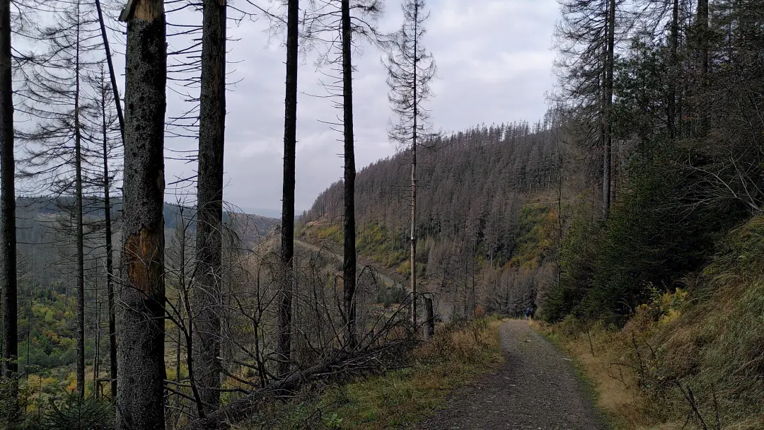
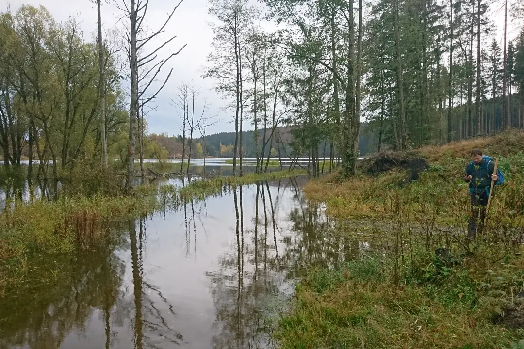
The mountain had its own challenges, not because it was steep or particularly high, but because it had rained in the days before, and that's a bit of an issue in the Harz region... Unfortunately, we have this little, possibly civilization-threatening problem called climate change. It's causing the spruce trees to not feel so comfy in their usual habitats anymore. The drought in recent years has made them vulnerable to the bark beetle. In the Harz (and elsewhere), this has led to thousands of trees dying. Entire mountain ridges in the Harz are now empty. Trees stand dead in the landscape, bark peeling off, and eventually, they either get cut down or fall on their own.
This big problem, on a smaller scale, led to a real mudfest for us. A few wet days plus a harvester and some other heavy machinery turn every forest path into a mud desert where hikers have to figure out how to move forward. We eventually made it, but it was quite an adventure.
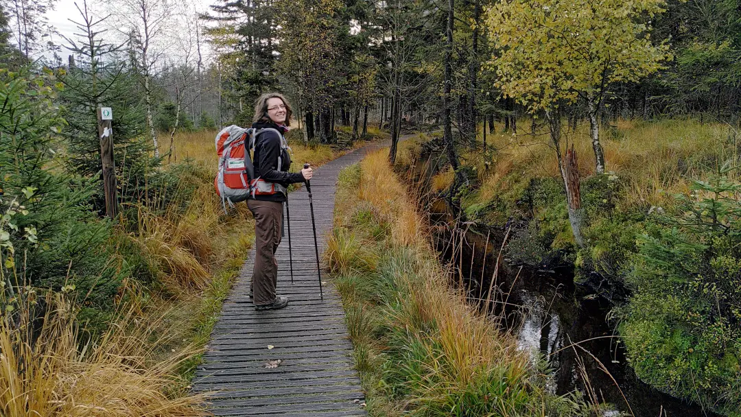
Later on, things got a bit nicer. The western part of the trail passes through the Oberharzer Wasserregal. This is a huge, centuries-old hydrological system with hundreds of kilometers of channels, weirs, and reservoirs. The purpose of all this was to supply enough water for use in mining. Mining had a bit of a strange problem back then: too much water, which is why they needed even more water. In our hometown, we also have these so-called "Berggräben" (mountain ditches) that Goethe revived, and their purpose was to bring water from the mountains. Same principle, just smaller. The goal was to have enough water available to power waterwheels, which in turn would pump water out of the mines. In other words, they used water as an energy source. Electricity wasn't a thing yet.
For this application, a lot of infrastructure is needed, of course. First, the water needs to be collected. Collecting ditches run along the mountainsides, basically throughout the entire Harz west of the Brocken. These ditches collect the water and direct it into various storage lakes. This has the advantage that, on one hand, the runoff can be regulated, meaning heavy rain doesn't immediately destroy the entire infrastructure of the mines, and on the other hand, a constant flow of water can be maintained even in dry periods. The goal, of course, was to power the pumps for the mine water, and its quantity hardly depends on the amount of surface water (and especially not directly, but with a long time delay). In other words, even if it's dry on the surface, pumping is still necessary below.
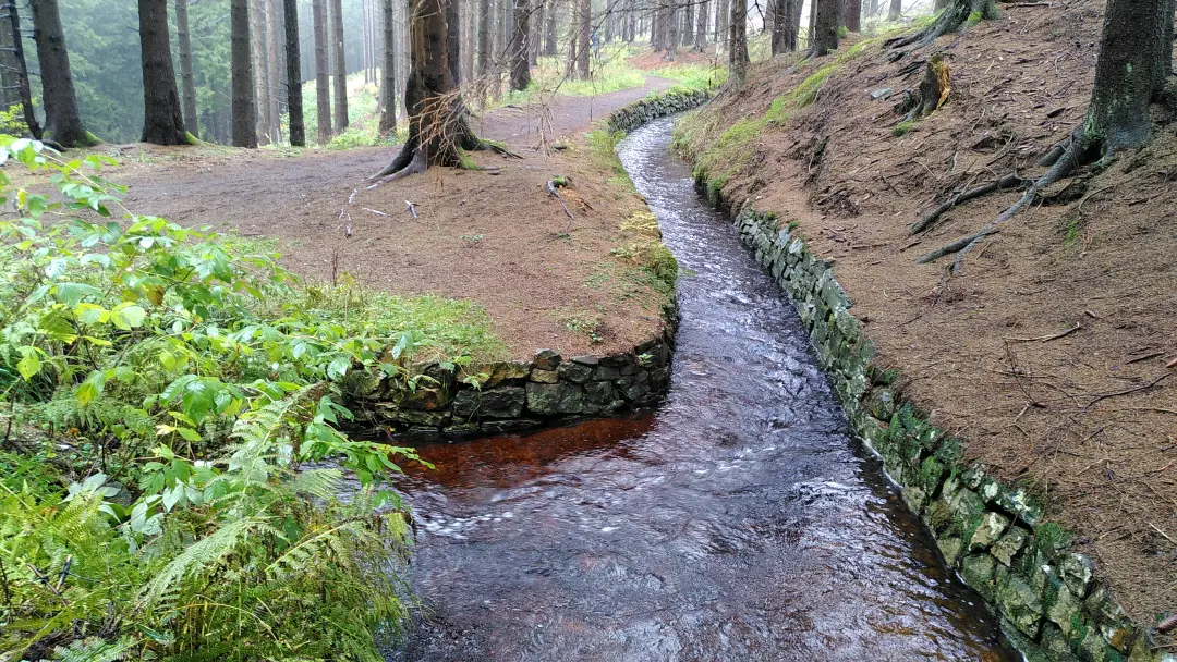
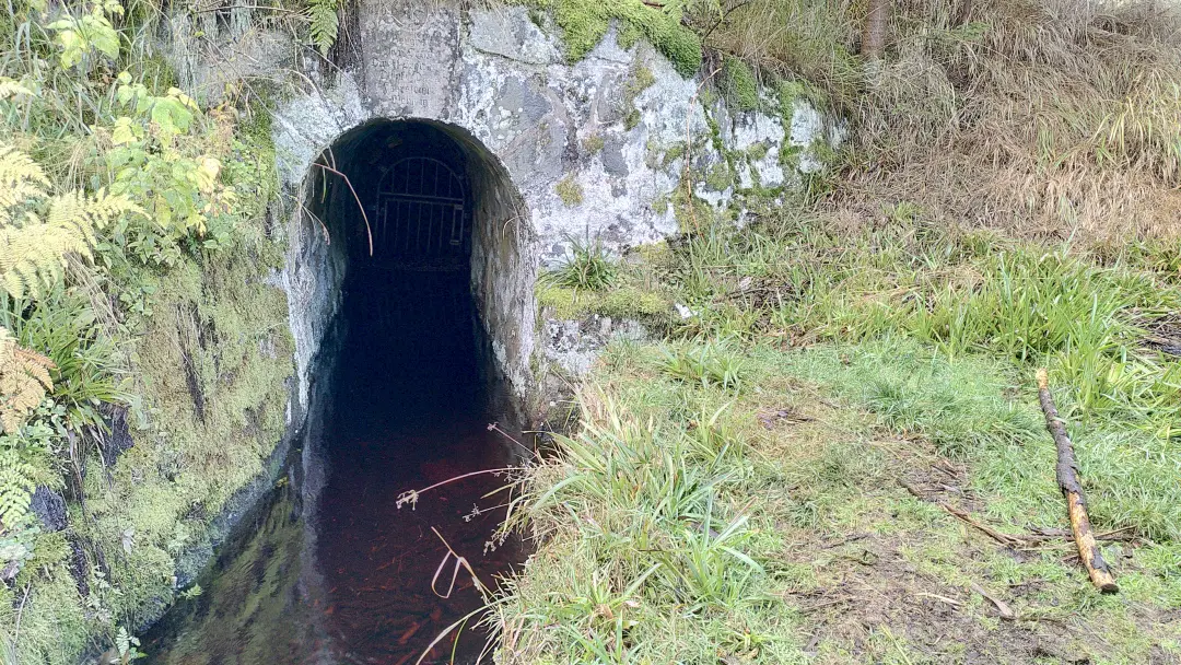
Even though these water ditches are primarily man-made infrastructure, they are now situated in very idyllic locations. Right through the forest, almost always along the contour lines (you have to cover long distances and not lose too much elevation). The (probably) former maintenance paths are now hiking trails and part of the Hexenstieg. Especially out of the season, they are quite secluded, which makes the hike even more enchanting. One ditch fascinated me in particular: because they sometimes needed more water at one of two places, depending on the season, they simply carved a 5 km long almost horizontal ditch between two ponds into the mountain. This allowed them to move water back and forth by damming one or the other pond. The entire ditch had to be dug by hand because blasting the rock would have made it crack and the ditch leaky. The precision of digging a 5 km long ditch along a contour line with only a few centimeters of deviation is fascinating in itself. Not to mention the effort.
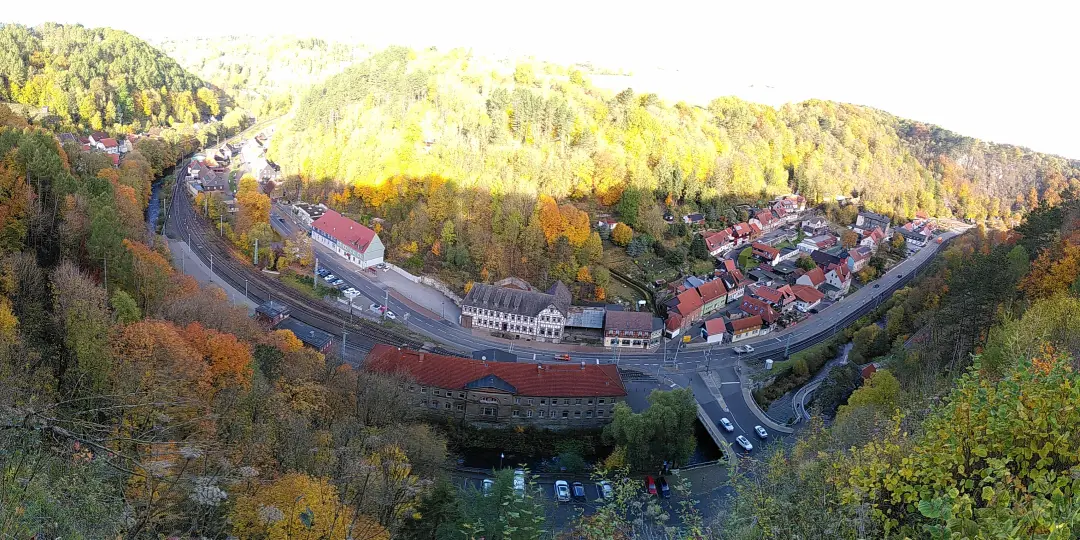
The evening ended at the Hotel zur Schmiede in Altenau. It had a bit of an 80s charm, but was actually quite nice. Altenau is rather hilly, and the hotel is relatively high up on the valley's side. So, we made our tired legs (which definitely found the weight of the backpacks quite lamentable. Without luggage transport, it's a bit different and requires more training.) go down the hill (and later back up) for a delicious dinner. Of course, it was all pandemic-compliant with electronic registration and plenty of distancing. It was delicious nonetheless.
Day 2 - Being young again
Well, not exactly young again, but at least back to the youth hostel. But let's start from the beginning...
The next morning, we had to head downhill again (Altenau is hilly, as you may recall) to the local tourist information center. Our goal was to complete the Harzer Wandernadel, which required a stamp booklet to collect stamps at various stamping locations. These booklets are typically available at tourist information centers or sometimes at hotels. Unfortunately, our hotel in Osterode couldn't assist us. They had some issues obtaining the booklets from their tourist information center, so they simply ran out of them. Consequently, we couldn't collect any stamps on the first leg of our journey. This was frustrating because the Harzer Wandernadel has different levels and you need a certain number of stamps to achieve each level. Additionally, we wanted to earn the Wandernadel specifically for the Hexenstieg trail, which also required the corresponding stamps, of course. I have no idea what the problem was in Osterode, but they need to get their act together! The kind lady in Altenau provided us with the necessary materials, so we could diligently collect stamps.
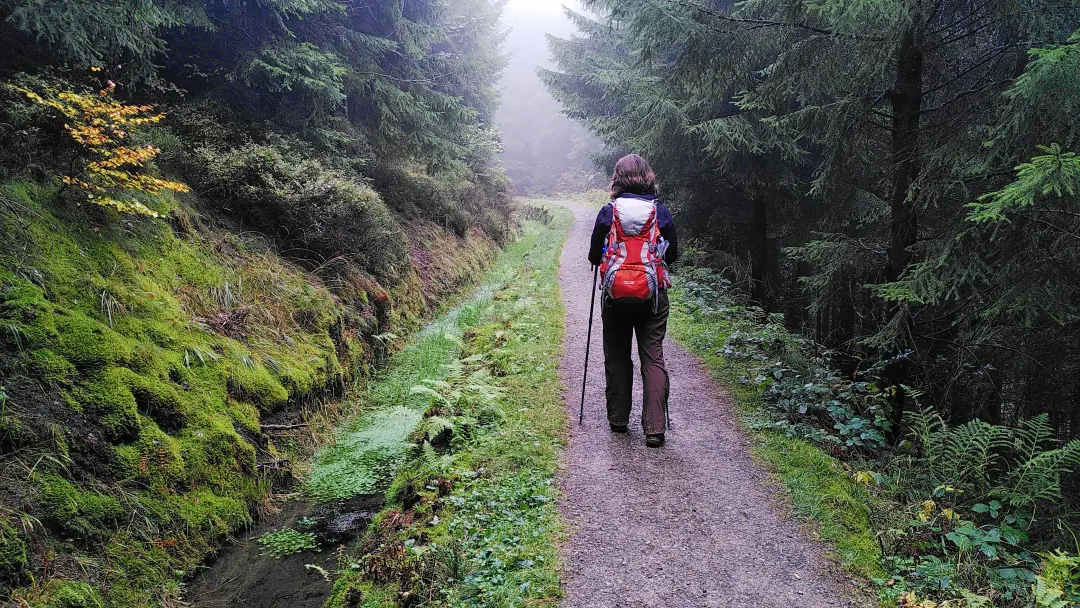
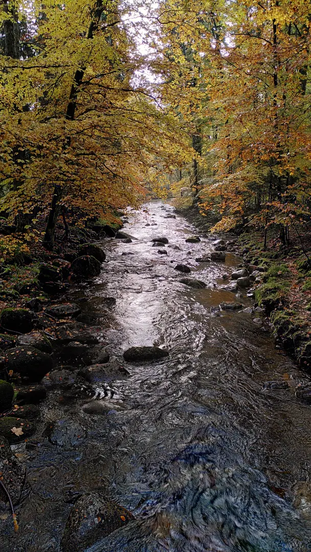
After a brief visit to the pharmacy (pain relief gel is essential, as we learned the day before), we first had to leave the valley. That was going to be a theme for the day. It eventually ended up on a mountain (although not quite at the top of the Harz, but close). A wildly romantic valley with a babbling brook (thanks to the rather wet weather), a leisurely morning hike - what more could you ask for?
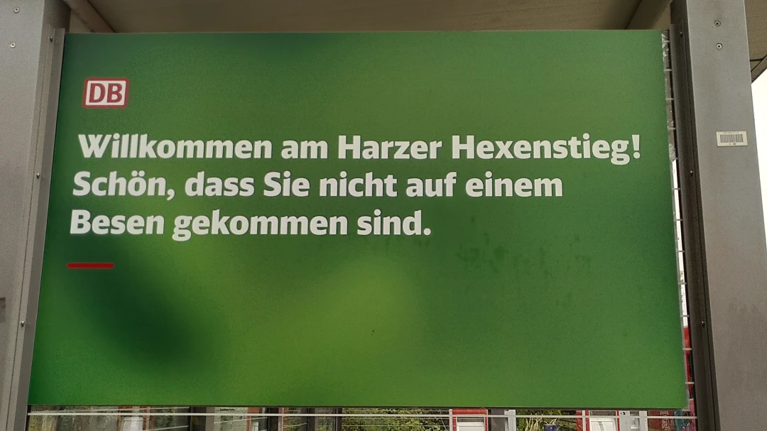
Once you've climbed out of the valley, the trail flattens out a bit. At some point you cross the road between Altenau and Torfhaus and there was my personal favorite sign of the day:
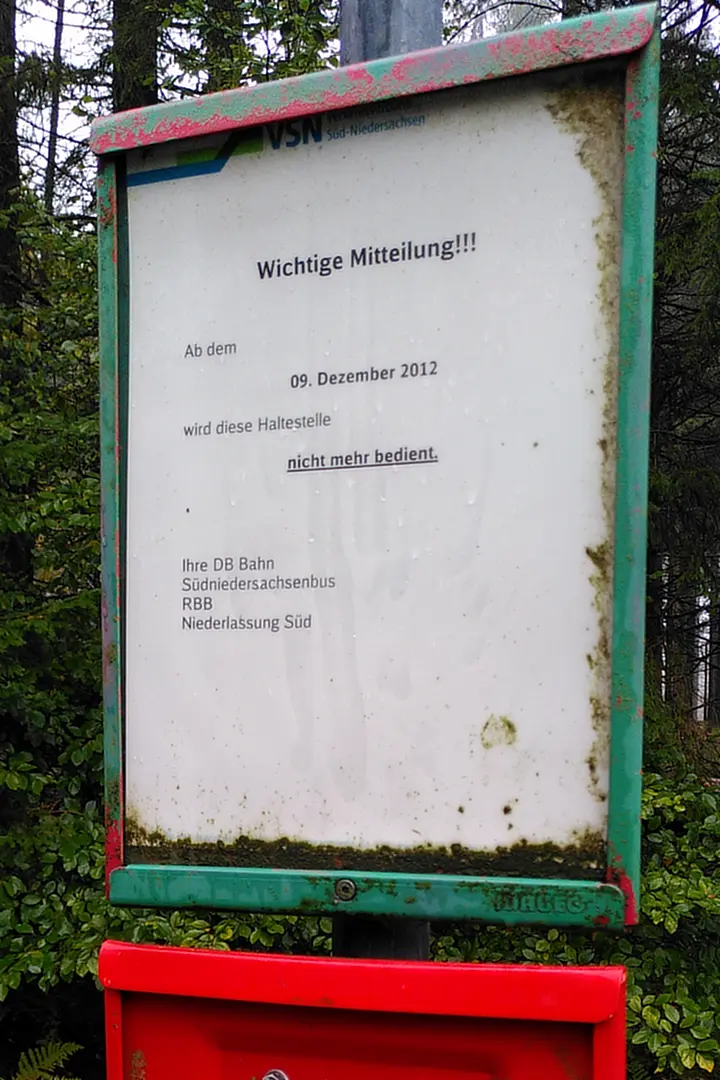
So, we had to keep walking. There was definitely no hope of a bus here. But that was fine because the landscape was equally idyllic as the day before and we were eager to continue hiking.
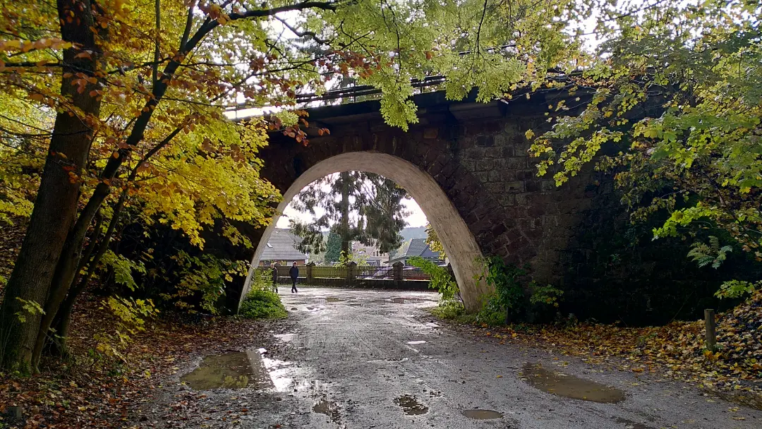
The trail led us alongside the Dammgraben for a significant part of the day. This is one of the more active ditches, so you have the soothing sound of flowing water by your side all day long. There was only one point where we had to leave the ditch temporarily: it goes through the mountain and you have to go over it. Additionally, there was also a detour due to the risk of falling rocks on the original hiking trail. The detour turned out to be quite challenging. Climbing up a steep section wasn't too bad. However, the steep descent on the other side, which would have been manageable in normal conditions, became a bit tricky because of the wet and muddy terrain. Despite our cautious approach, we both had more than one near-slip.
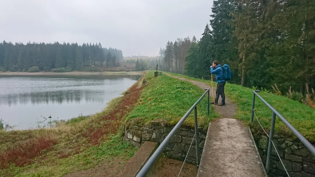
Eventually, we left the Dammgraben behind and started a steady ascent. Our overnight stay was going to be at the hilltop in Torfhaus. As is befitting people who are slowly getting older, we had booked an overnight stay at the youth hostel (which seemed to cater mainly to school classes and older folks). On the way we had another chance to witness the impact of climate change and drought on the spruce forests in the Harz: entire mountain ridges were now nothing more than dead trees.
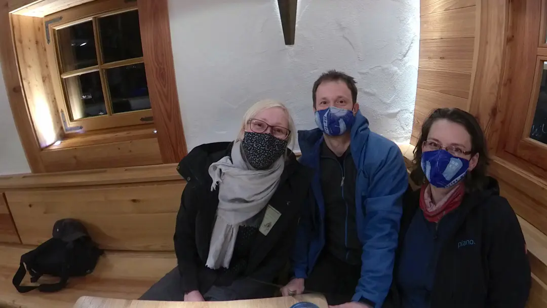
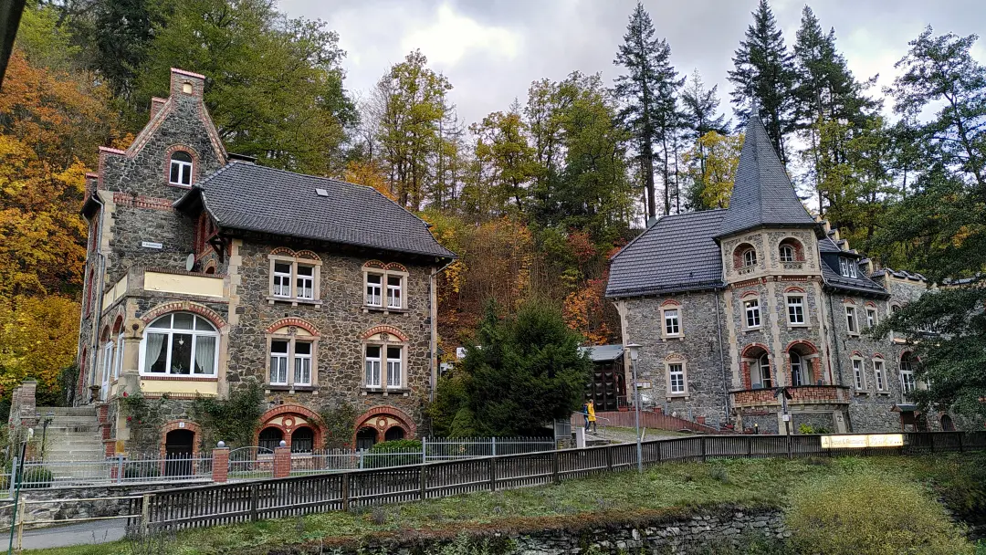
In the evening in Torfhaus, we finally got to spend some time with Lütti. Even though she couldn't join us for the hike, she managed to visit us briefly for dinner. Torfhaus boasts the famous Bavaria Alm (well, famous for some people, apparently - I had never heard of it before). It's like a piece of Bavaria in the Harz, kitsch and all. But the dinner was delicious. We also had the opportunity to briefly being driven around in a vehicle on the same platform as our (then future) car. It was quite an experience.
The return to the youth hostel was, thankfully, in the car. After all, the next day, we were planning to conquer the highest mountain in the Harz...
Day 3 - Shut the door! It's drafty in here!
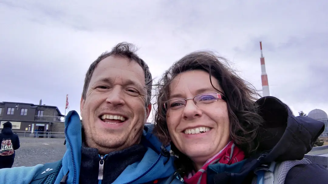
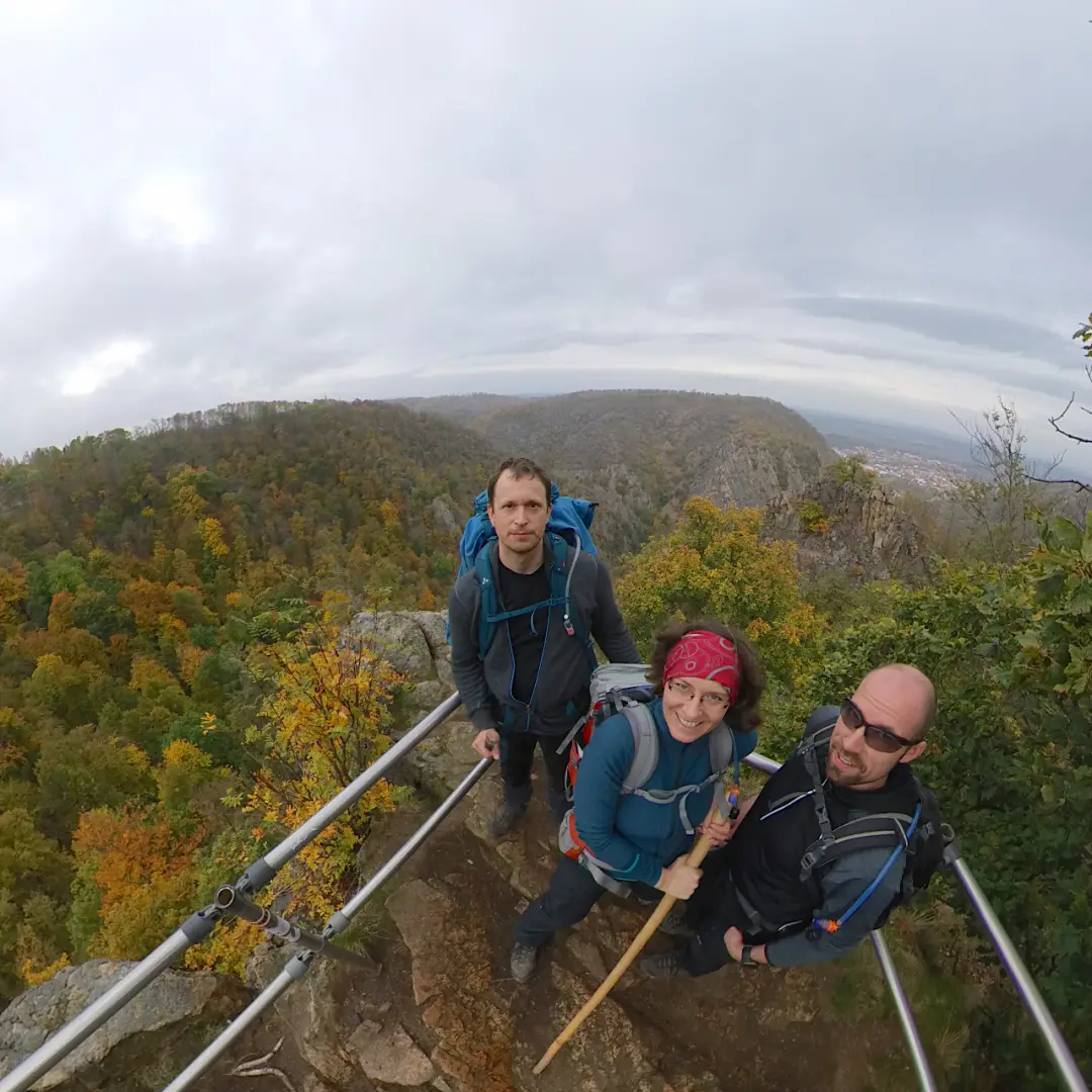
The third day began with an uphill climb. After all, we were headed to the Brocken, which is the highest mountain far and wide. Starting from Torfhaus, we first strolled through a moor, always keeping our eyes on the distant Brocken.
Eventually, the path became steeper and changed from natural terrain to concrete. This concrete trail was once the patrol road of the East German border troops. During the time of the German Democratic Republic, the Brocken was on East German territory but was off-limits as a restricted area (except for intelligence officers and, interestingly, meteorologists who collected climate data there). Consequently, like other areas along the GDR border, the Brocken was surrounded by security installations, including these concrete patrol roads. Today, they are usually the only remnants that remind us of the former inner-German border. They carry a certain eerie aura, as they serve as a reminder that this was once a place where people would have been shot at.
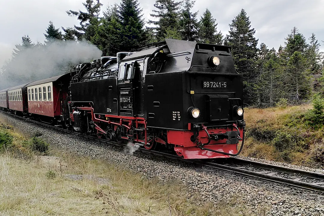
Today, the biggest danger is getting run over by a steam locomotive, and even that's not very likely. The Brockenbahn (Brocken Railway) audibly chugs its way up and down the mountain, offering plenty of photo opportunities. It winds its way through the forest from Schierke to Brocken station, overcoming an elevation difference of about 440 meters. But we were here for hiking, not taking the train, so we only have photos from the outside.
Upon reaching the summit, we were thoroughly aired out. High mountains in autumn often mean a lot of wind. It was so windy that we suddenly felt like we were being sandblasted when someone walked a few meters away, kicking up sand from the ground with their feet. We did some sightseeing, took photos, and that was it. The view was stunning, but eventually, we'd had enough of the wind. So, we descended on the other side.
Descending the other side turned out to be much more strenuous than we had expected. The long downhill stretch was tough on our legs. Heavy backpacks and downhill terrain are not a pleasant combination, especially for the knees. And from the Brocken to Schierke, it's a long downhill journey. This time, even my knees rebelled. After some more limping, we finally made it to our accommodation. We treated ourselves to some delicious cake and later had dinner, but otherwise, we retired to bed quite early.
Day 4 - Water, lots of Water...
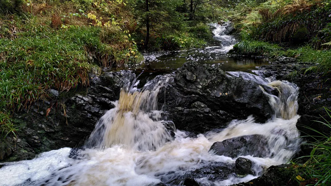
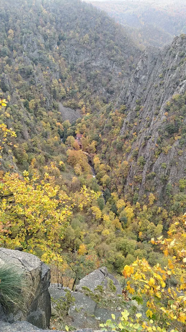
Day 4 started with a trip through a figurative and literal "Elendstal" (Valley of misery): our knees were still quite sensitive, and indeed, a part of the path was actually called "Elendstal." The Elendstal is a small but lovely nature reserve that takes you from Schierke to the town of Elend (misery) (cool name).
In Elend, the valley of the Kalte Bode widens considerably and turns eastward. At the Mandelholztalsperre, we encountered the same mud and water problem we had on the first day: the reservoir had overflowed its banks and blocked our hiking path. So, we had to take a short detour uphill to have a chance of continuing with relatively dry feet.
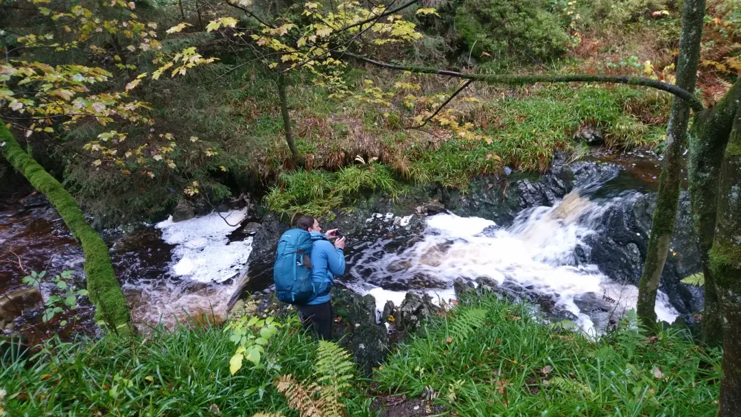
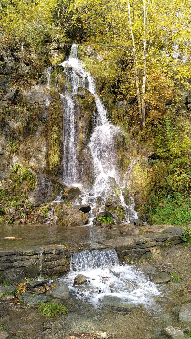
We encountered falling water in the form of the Königshütter Wasserfall. It plunges 15 meters into an old quarry. You wouldn't guess it, but this waterfall is man-made. Created in 1994, it has become a small local attraction and serves as a stamp location for the Harzer Wandernadel. Since we were equipped with a stamp booklet thanks to the Altenau tourist information, we diligently collected stamps before continuing along the Kalte Bode towards the town's exit. Somewhere there, the Warme Bode (which probably isn't much warmer) joins from the south, and they flow together as the Bode into the Königshütte Reservoir.
The reservoir might seem unspectacular on the surface, but underneath, it's quite interesting: an almost two-kilometer-long tunnel connects the Bodetal with the Rappbodetal, where the largest reservoir in the area is located (which we didn't visit that day). This way water can be transferred from one valley to the other and stored in the Rappbode Reservoir. The two valleys actually meet below the Rappbode Dam, so without the Königshütte Reservoir and its transfer tunnel, the water of the Bode would simply flow past the reservoir system. Even today, intricate water management systems are built in the Harz to maximize water utilization.
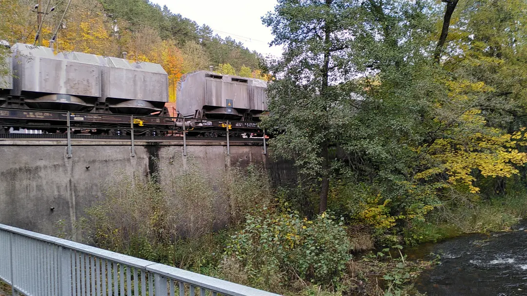
But for us it was time to continue along the Bodetal for now towards Rübeland, where we had accommodation for the night. At least at the entrance to Rübeland, it was pretty loud. A massive limestone quarry not only dusted up the landscape but, combined with the nearby limestone plant, its crushers, and trains for material transport, created quite a din. Quite a contrast to the tranquility of the forests, reservoirs, and waterways of the previous days.
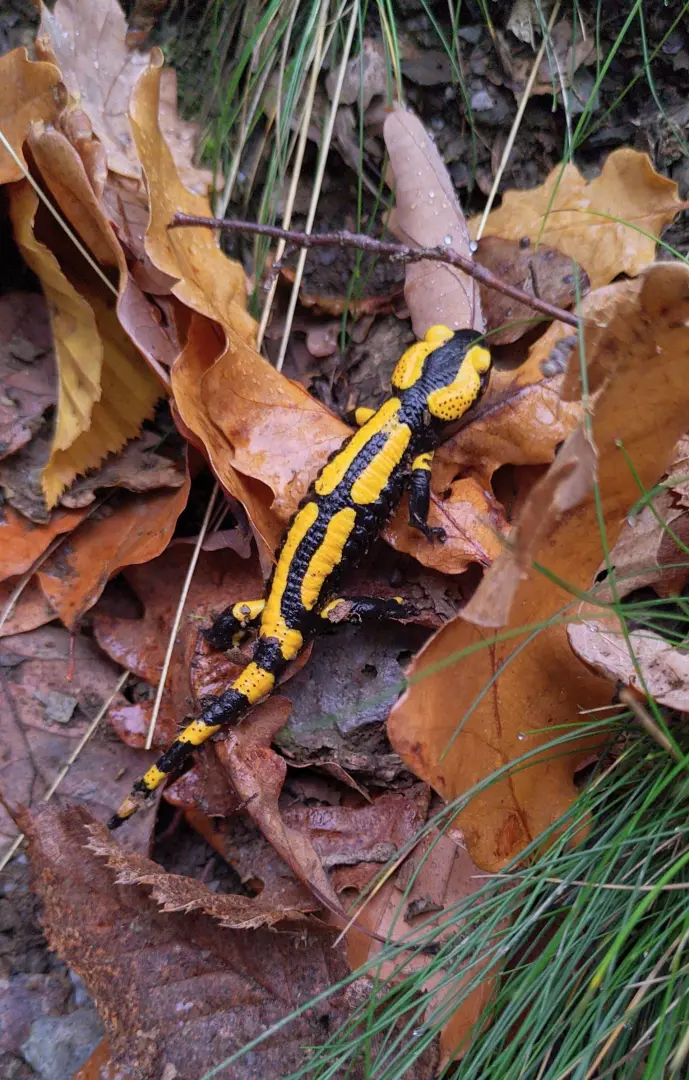
In Rübeland, we met up with Daniel. When Lütti had to cancel at the last minute, Daniel had joined us for the second half of the hike. Since we had accommodations for three people anyway, it made sense. He had taken the train and a hike to Rübeland on that day (probably a bit of an odyssey as well), visited the Hermannshöhle with its cave salamanders, and then waited for our arrival.
Together, we covered the last stretch towards our hotel. It was quite a large hotel for the offseason; we were three of (if I recall correctly) 7 guests. It felt a bit like The Shining. But at least the hotel served a delicious dinner, and in the end, no one came around with an axe.
Day 5 - Impressive Infrastructure and Daredevils Galore
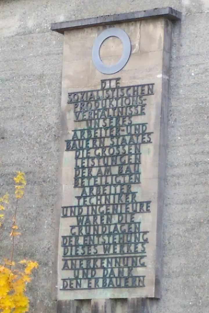
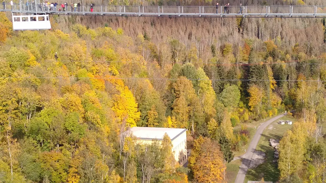
The next morning began with an uphill climb to the Pavilion Hoher Kleef, which we wanted to conquer before enjoying the view over Rübeland. After that, we trekked through the forest towards the dam of the Rappbode Reservoir, which happens to be the tallest dam in Germany, standing at 106 meters. We didn't measure it, but it was undeniably impressive.
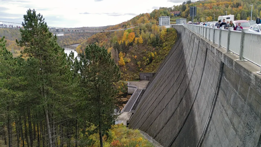
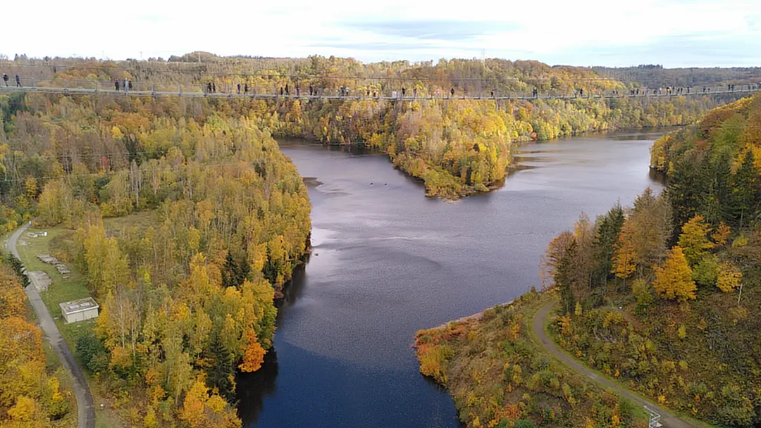
Around the dam, a variety of tourist attractions have sprung up (which, by the way, led to quite a bit of traffic on the access roads, but luckily, we were on foot). There's a pedestrian suspension bridge (the second-longest in the world with a 458-meter free-hanging section), bungee jumping (from the suspension bridge, to make the thrill worthwhile), and Europe's longest zipline, stretching 1000 meters, where two people can shoot across the valley below the dam on a steel cable. It's all about thrills. However, on that day, we chose the less thrilling path and crossed the crest of the dam. It just felt more stable. Nevertheless, it was impressive.
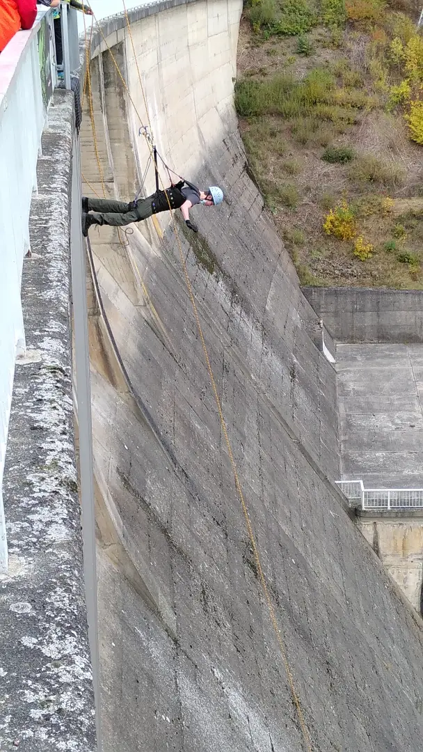
Since we had chosen the boring route, we had to descend to the dam of the Talsperre Wendefurth at the other end (with the zipline, you would have almost arrived there). There, you could have indulged in another adrenaline rush: Wallrunning (back then, it was still done on the dam; now, it apparently goes down from higher up at the new lookout tower). And, as luck would have it, another daredevil was plunging downward.
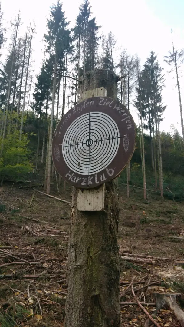
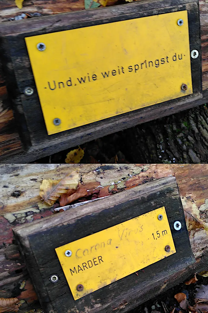
After that, things got quieter again. We continued along the Bodetal to Treseburg. Along the way, there were a few games and learning opportunities for kids, which we gladly embraced: pinecone target throwing and long jumping (with comparisons of jump distances of different animals).
Our hikes have a... let's say, "remarkable" tradition: the last 1000 meters are called the "Nörgel-Schnörkel" (the Grumble Wiggle). They always seem to stretch on forever: you still have to go, but the excitement has waned a bit. On the Nörgel-Schnörkel, Manu is allowed to complain. Complaining before that is prohibited. Daniel and I, of course, didn't miss the opportunity to count down the Nörgel-Schnörkel accordingly. Much to the amusement of my wife...
The day ended quietly with a delicious meal at the Hotel Zur Luppbode. A peaceful evening to prepare for our last day of hiking to Thale.
Day 6 - Sprint to the Finish Line
The sixth and final day was relatively short (we still had to take the train back home) and began with an (expected) disappointment: the most picturesque and wildest part of the Bodetal between Treseburg and Thale was closed. We knew this in advance, but it was still a bit of a letdown. However, at least this gives us a reason to come back when Lütti decides to do the hike someday.
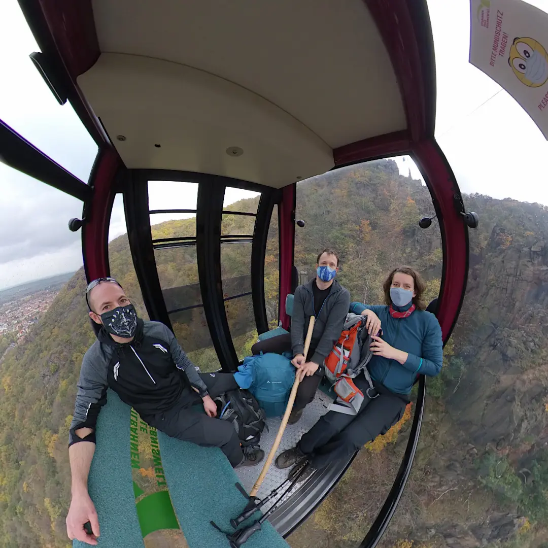
This time, we had to climb out from Treseburg and walk over the mountain towards the Hexentanzplatz (Witches' Dance Floor). By doing this, you naturally bypass all the twists and turns of the river valley, which significantly shortens the route. So, we were already at the Hexentanzplatz by noon. While you can certainly spend more time there, eventually, it was time to move on.
After having our fill of the attractions at the Hexentanzplatz (including a brief visit to the zoo), we headed to the gondola for the descent. We had enough downhill hiking behind us, so we opted for the comfortable route down.
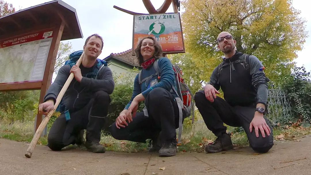
After a short walk through the town to the train station, the hike came to an end. We had covered 112 km from Osterode to the photo under the Hexenstieg trail's finish line sign (the actual Hexenstieg is a bit shorter, but we had added some extra distance due to a few detours for accommodations). The tourist information office was right at the station, so we were able to pick up our Harzer Wandernadel badges (in bronze and silver) while waiting for the train. Afterward, it was time to board the train, and after a few hours, we were back in familiar territory.
Epilogue
A few days later, we unexpectedly received mail from Thale. We hadn't realized that we had left our stamp booklets for the Harzer Wandernadel in the tourist information office (along with our tour data). They played a bit of Sherlock Holmes, got our address through one of our hotels and sent us everything. Thanks again for that! We might want to expand our stamp collection someday.
The hiking trail is definitely worth a visit. Especially outside of the peak season, it's beautiful and wonderfully quiet. The Harz landscape, particularly in the autumn, offers some beautiful sights (although unfortunately, climate change is taking a toll on some parts). We tried a hike without luggage transport and (mostly) succeeded. Manu is still enthusiastic, so I can look forward to many more hikes in the future.