What a Heat Battle - Ith-Hils Trail 2022
After the rather damp and chilly experience in the Harz more than a year and a half ago, we decided to move this hike to the summer. After canceling in 2021 due to that strange pandemic, we opted for July instead of October this time.
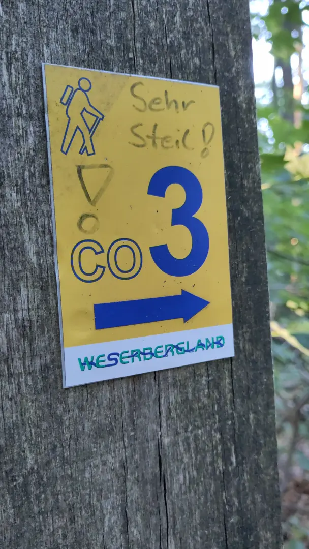
We headed a bit further west into the Weser Uplands (German only). We chose the Ith-Hils Trail, a circular route over the Ith and Hils (surprise!). These are two mountain ridges offering surprising amounts of nature and very little civilization (at least during the hikes themselves – no need to sleep in caves!). Hiking in July... "summer temperatures" doesn’t quite capture it. "Heat battle" is more like it. But let’s start from the beginning...
Contents
- Contents
- Arrival - Surprisingly Cheap This Time
- Day 1 - A Short Cave Tour and a Lovely Dinner
- Day 2 - A Hike with Two Mountains... and a Hotel All to Ourselves
- Day 3 - 38 °C and, well... you know
- Day 4 - 11 ½ Liters of Water and the Start of a Horror Movie
- Day 5 - Cooler Temperatures and a Little Water from Above
- Day 6 - Back to the Start
- Last Day & Return Journey
Arrival - Surprisingly Cheap This Time
This time, getting there was exceptionally affordable. In 2022, Germany actually experimented with accessible public transport and introduced the 9-euro ticket. While it meant a bit of meandering on regional trains, the price was, of course, unbeatable.
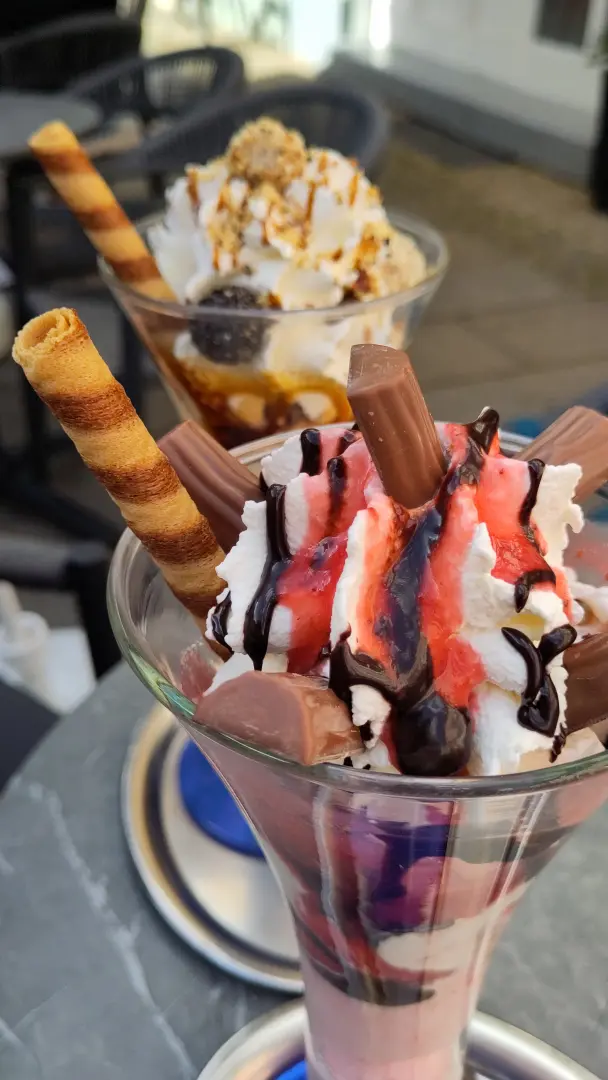
After about 3.5 hours on regional trains, we arrived at Alfeld (Leine), backpacks strapped on and slightly concerned about the weather forecast (warm, warmer, and very warm). We had time to enjoy a leisurely ice cream and a stroll through Alfeld’s town center before checking into our hotel room.
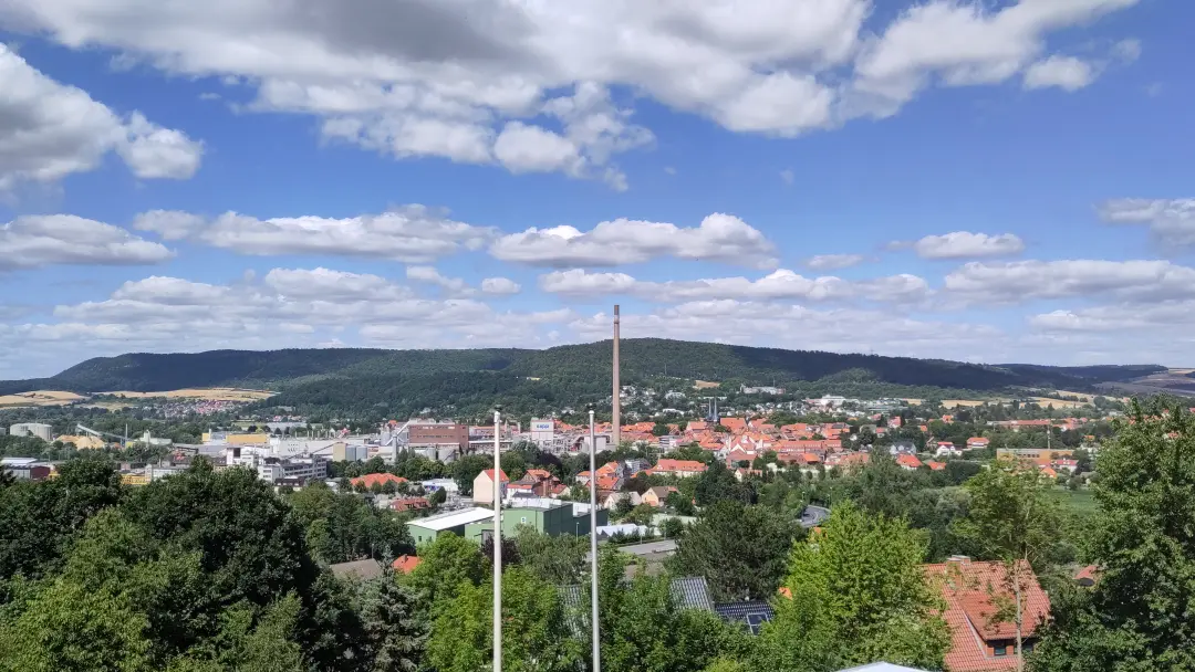
Alfeld is dominated by a large paper mill from nearly every angle. Apparently, paper production has a long tradition in the town, and the factory has expanded significantly over the years, now occupying a central position in the city (complete with a tall chimney). An interesting contrast to the medieval old town right next door.
That evening, we had another short stroll back to the train station for a good reason: this time, everything worked out with Lütti. After some last-minute complications the year before, everything went smoothly this time and we picked her up in the evening. Then it was back to the hotel for a quiet night.
Day 1 - A Short Cave Tour and a Lovely Dinner
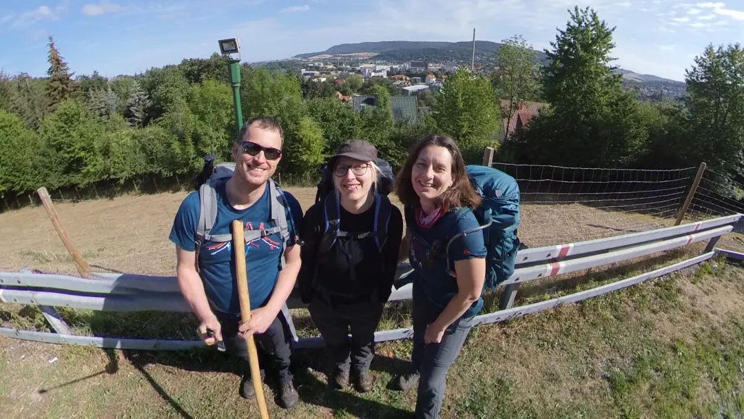
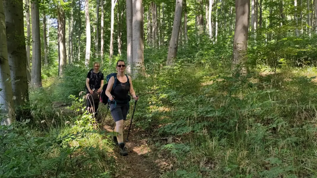
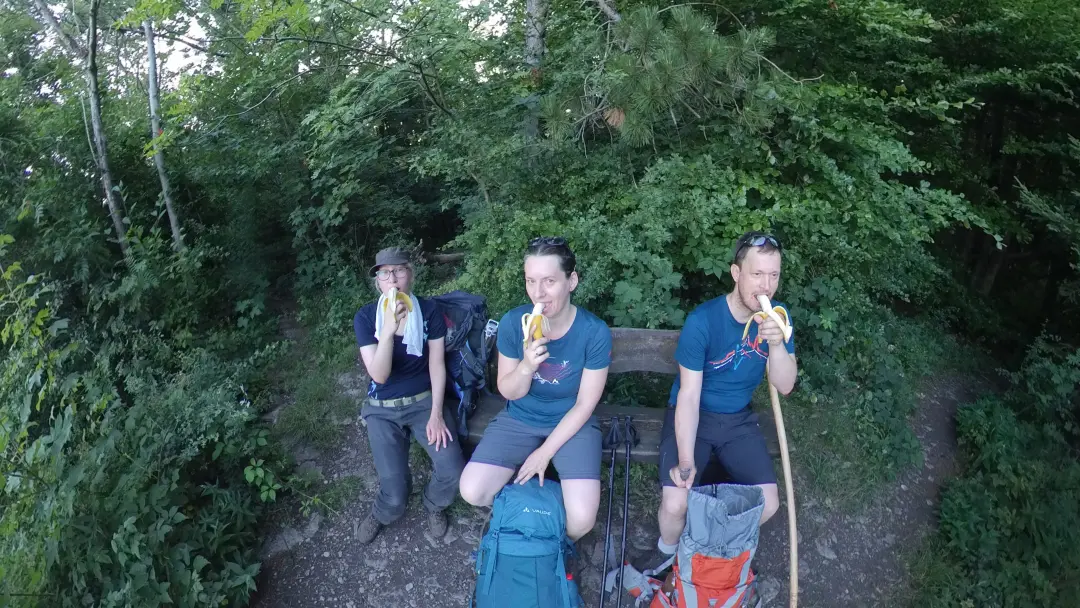
The next day we were up surprisingly early. In warm weather, starting before the sun gets too intense is generally a good idea. By just after 7:30 am we were ready to go, standing in the hotel parking lot with the route planned out. After a quick “And we're off...” selfie, we headed downhill (the hotel was, as the photo shows, quite high up above Alfeld) to then ascend on the other side.
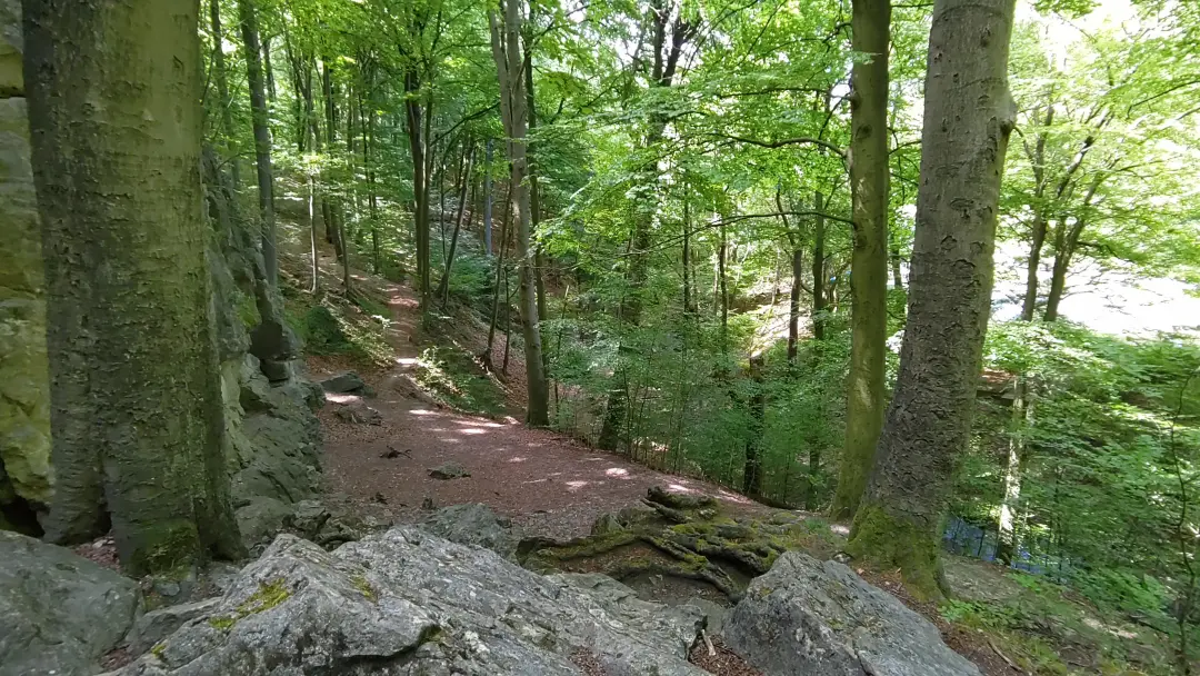
The best thing about the entire hike (and the critical factor that made it possible this year) is that almost the entire trail is in the forest. It runs along various ridges, which are thankfully densely covered with deciduous trees. Without that, the temperatures (especially in the upcoming days) would have been unbearable.
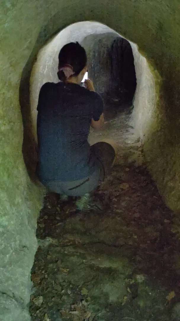
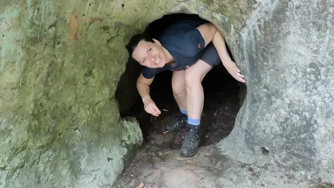
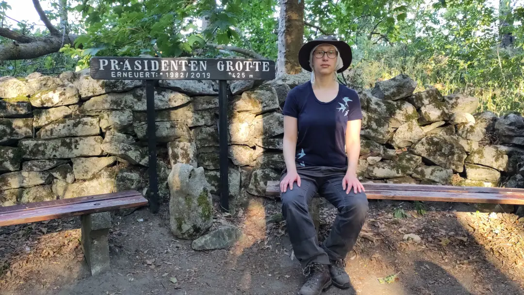
The first highlight of the day was the Lippold Cave (link in German), supposedly once home to the bandit Lippold. In reality, the original natural cave was expanded over the years and now consists of three rooms: kitchen, living room, and prison. The rooms are connected by extremely narrow and low passages, some accessible only by steel ladders. It was likely never particularly comfortable, even at its peak. You need to be reasonably agile (and not overly chubby) to get everywhere inside the cave fully. Oh, and claustrophobia would be a problem.
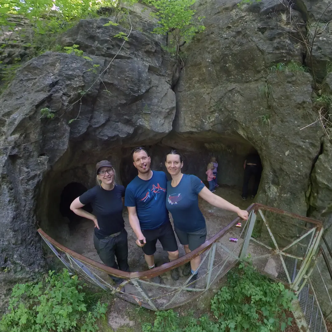
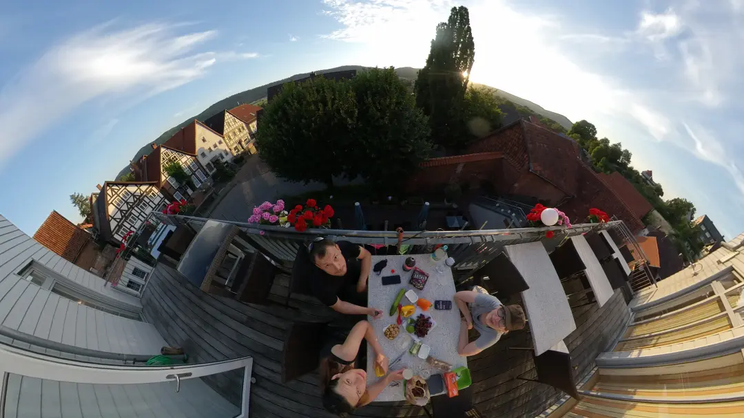
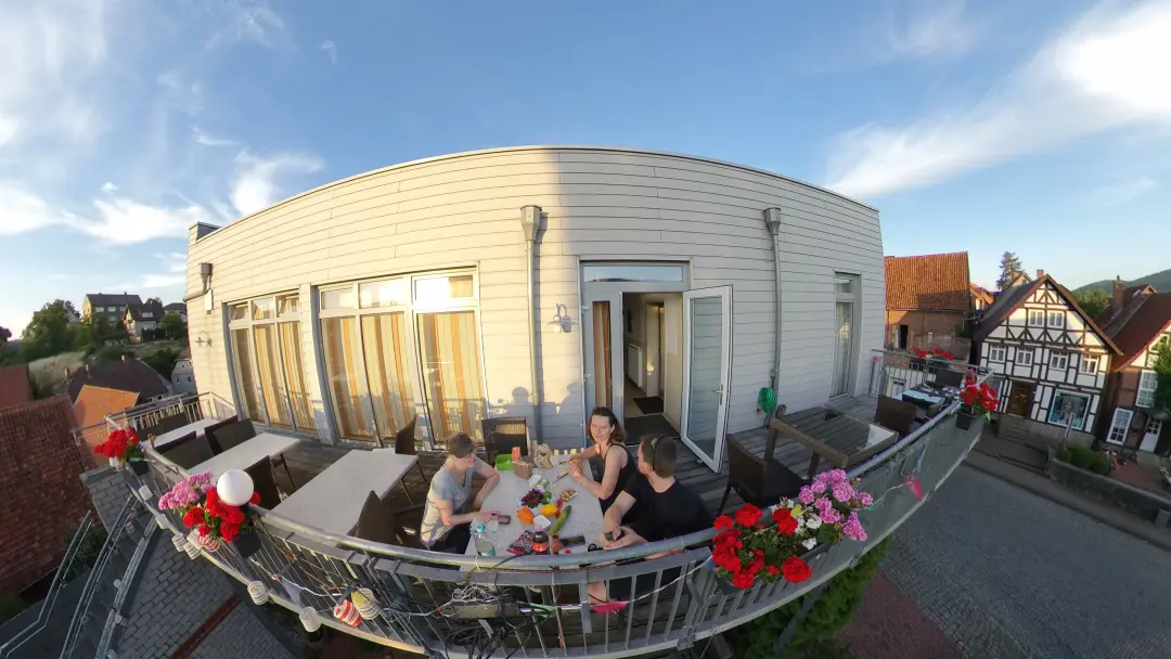
We had a small packed lunch at the cave (no facilities there) and continued to Brunkensen, where we’d managed to book a room for the night before our hotel closed for the the summer holidays the next day.
This had initially caused some booking challenges: the hotel restaurant was supposed to be closed that evening (it ended up being open, but we didn’t need it anymore). Brunkensen isn’t exactly a culinary hotspot, so dinner posed a bit of a problem. Then, a few weeks earlier, fate intervened. Manu is active in the Enyaq forum and, by chance, learned that one of the forum members lived near the Hils. She jokingly suggested waving from the Hils, which led Volkmar and Chris to invite us over for dinner. Conveniently, it was on the evening when the hotel wasn’t supposed to serve food.
We set out for the neighboring village, where the two live with their eight dogs. Yes, eight dogs. They’ve spent years rescuing and rehabilitating stray dogs from Portugal and Romania, and some have stayed with them. We had a wonderful evening with delicious grilled food and plenty of dog hair before Volkmar kindly drove us back to the hotel.
Day 2 - A Hike with Two Mountains... and a Hotel All to Ourselves
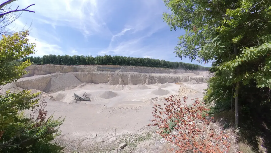
Day 2 brought a little heat battle, at least right at the end. It was warm throughout, but the old quarry near Salzhemmendorf was another level altogether.
The morning started a bit more relaxed this time. Around 9:30, we got our still somewhat tired bodies moving on the hiking trail uphill to the Duinger Berg. As on the day before, the ascent was quite manageable: about 180 meters in elevation gain overall, but still pretty tolerable and, most importantly, shaded. This gave us time for a detour to the Kirkedal Landslide.
As the name might suggest, a steep slope slid down here at some point. It sounds moderately exciting — and that’s about right. While some of the broken rocks are indeed impressive, the majority of the slide is now completely overgrown, so there isn’t much to see. We continued uphill until reaching a plateau with a bit of a view.
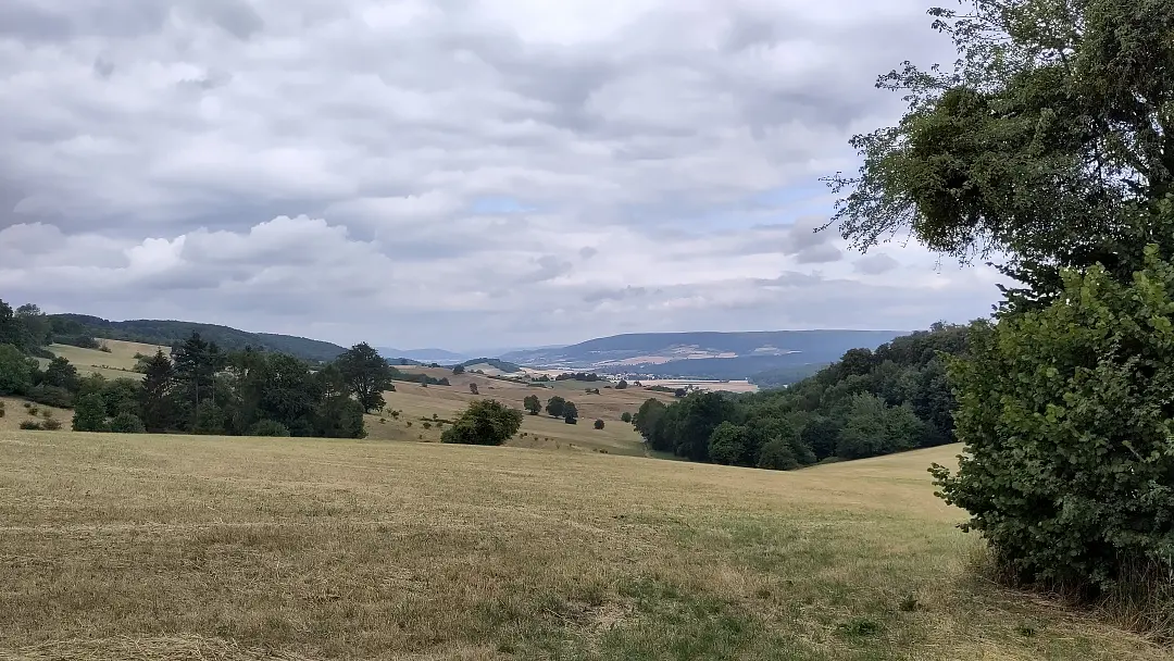
The path quickly dips back into the forest and continues uneventfully to the Leinebergland Balcony. This spot offers two attractions: a view of the Leinebergland to the northeast and the quite impressive Marienhagen Quarry.
The limestone, that is mined there, forms the foundation of the entire landscape. The bright white rock provides a stark contrast to the green of the surrounding environment.
From the Leinebergland Balcony, it was a steep descent toward Marienhagen. The Duinger Berg came to an end, and the path headed for the Thüster Berg. The Ith-Hils Trail manages to bypass the village of Marienhagen almost entirely, keeping it hidden behind bushes and trees.
The Thüster Berg is again densely forested, providing lots of greenery and peace. The highlight of this section is the Löns Tower (link in German) on the Kanstein. Named after Hermann Löns, the “Heath Poet” (who would later cross our paths again on a trip to the Lüneburg Heath), who often visited the area. This is much like at home, where every second thing is named “Goethe-something.” Poets seem to have a knack for getting things named after them.
The tower is an interesting structure: initially planned to be 28 meters tall, budget constraints limited its original height to 18 meters. Eventually, the surrounding trees grew so tall that the “view” extended only about 20 meters into the treetops. In 1972, a metal structure was added to raise the tower to 23 meters, and then in 1997 to 26 meters.
Looking at the tower now, you’ll see a sandstone base (the original structure) with two observation decks above it (the additions from 1972 and 1997). Fortunately, the surrounding beeches have now reached their full height, so there’s no need for further extensions anytime soon.
The Löns Tower marked the last geographical “high point” of the day. From there, it was a steep descent to Salzhemmendorf. Along the way, we passed through the aforementioned quarry.
Although it’s no longer operational and has been replanted with trees, they don’t yet provide much shade. The sunken basin facing south traps and retains heat. Those 500 meters through the quarry were sweatier than the entire previous day’s hike.
In Salzhemmendorf, we had booked rooms at the Ratskeller. Interestingly, both the restaurant and the hotel were closed that day. A key had been left for us, so we had the entire place to ourselves.
We stocked up on provisions for dinner at the local supermarket and enjoyed our meal on the balcony of our rooms. Quite lovely...
Day 3 - 38 °C and, well... you know
Or maybe you don't. The title is a reference to German song from a few years ago. The first of the two hottest days of the year, and we decided to go hiking. Brilliant. But who could’ve guessed that when planning the hike months in advance? And arranging such trips on short notice is hard (unless you're into tent camping). In general, it’s tricky to find accommodations for just one night. Vacation rentals are usually a no-go since they prefer week-long bookings. Hotels are usually fine, but the more remote (and thus beautiful) the trail, the fewer hotels there are. So planning ahead is often necessary, leaving you at the mercy of the weather. Anyway, we filled all our water bottles to the brim and set off as lightly dressed as was reasonably appropriate.
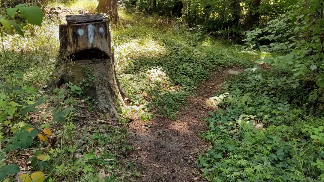
From here, we finally tackled the eponymous ridges of the trail. Up until now, we’d been hiking along the northern side of the loop on the Duinger and Thüster Berg. Today, however, the Ith awaited us. Well, sort of. First, we took a wide loop on the northwestern end to reach Coppenbrügge, so that we could tackle the full ridge the next day. The path led us along hidden, smaller trails again, giving the hike a wonderfully secluded charm. You wouldn’t expect that just looking at the map, but the trail routing is really well-designed.
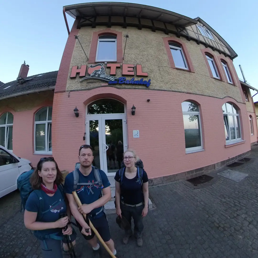
Our accommodation for the night was the Hotel am Bahnhof in Coppenbrügge. “Am Bahnhof” ("At the train station") is a bit of an understatement — it’s basically in the station. Or at least, it used to be. These days, the station is just a stop and the old station building has been converted into a hotel. The same building also houses a doner kebab shop, where I promptly managed to embarrass myself. We stopped there to ask about access to the hotel, and I leaned my walking stick against the counter for a moment. Suddenly, I heard a scratching noise followed by a crash. Without even looking, I knew what had happened — my stick had fallen, knocking over the empty beer glasses on the counter. What an entrance...
Despite this, we dared to return that evening to grab some dinner. A cozy evening on the terrace, watching people learn their train was not just delayed but canceled entirely... you know, the usual. Inevitably, the conversation turned to the weather again: the next day was forecast to be even hotter. It would also be our longest day: 23 km to Capellenhagen, nearly the entire length of the Ith ridge. Half-jokingly, we’d talked about starting in the middle of the night. While the ladies mulled over the difficulties of such a plan, I was more the “Ah, screw it, let’s just do it!” type (I usually am. There's a reason why I call Manu "the brain" sometimes.). Luckily, they quickly agreed to dash to the nearby supermarket before it closed, stock up on supplies, and then head to bed early. We planned to set out well before sunrise the next morning...
Day 4 - 11 ½ Liters of Water and the Start of a Horror Movie
The number of the day: 11 ½ liters. That’s how much water we distributed across our three backpacks to survive what turned out to be the hottest day of the year. We were up shortly after 4 a.m. — let’s call it “concious” — for our pre-hike selfie in front of the hotel.
Carrying that much water is its own challenge. Lütti has an unusual quirk: she doesn’t sweat. “Wow, cool!” you might think (especially if, like me, you tend to stick to your clothes in summer). But in 39°C heat while hiking, this becomes a problem for cooling down. Sweating isn’t just decorative, after all. We had already planned to use some of our water to keep her clothes damp if necessary. Adding to that, I was on medication at the time that caused excessive sweating (and thus higher fluid loss), so even with our abundance of water, it started to feel like we hadn’t brought enough.
The Ith-Hils Trail runs along the Ith ridge, a limestone formation. The ground is rocky and full of crevices, making water drain away quickly. The vegetation showed it — I'd never seen brambles drooping until that day. Thankfully, the trees provided shade, which was critical. Every time we stepped into a sunny clearing, it felt like getting hit by a hammer.
The heat sparked amusing conversations (in this case, with a passing couple):
"Hey. Warm today, huh?"
"Yeah, it is. But it gets better up ahead — it's practically snowing."
"Ah, good to know. Just a few meters back, there’s a nice, cool mountain lake."
Totally normal stuff.
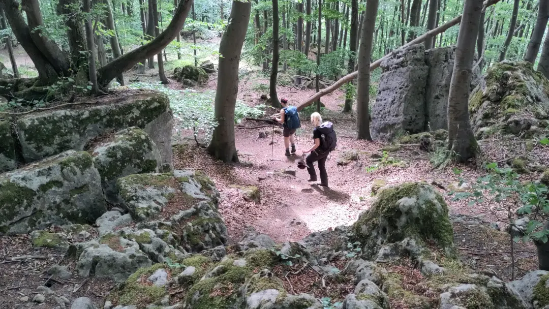
Eventually, my brain switched to autopilot and large parts of the hike became a blur. What stuck with me, though, was the sheer beauty of the trail. Much of it winds through a nature reserve on narrow paths — idyllic, even if sometimes interrupted by fallen trees. The views were stunning and expansive. The Ith stands alone in the plains, so between the trees, you can often see for miles.
The rest of the day was more of the same: narrow, scenic trails through (relatively) cool forests. By late afternoon, though, the water ran out, 2 km short of our destination. Even more than 3 liters per person wasn’t enough in this heat. Fortunately, the shortage came just as we were leaving the ridge to descend to our campsite. Still, those last kilometers were tough, especially as the path involved clambering over fallen trees and thick underbrush.
We finally arrived at an eerily empty campsite. Maybe it wasn’t the season or maybe there was another reason. The outdoor sinks looked dusty and unused, filled with old leaves. But we didn’t care — we were parched. We opened all the faucets, let the water run a bit, then drank a few handfuls of fresh water. I’m genuinely glad to live in a country where I can trust even a campsite’s outdoor taps.
The evening brought a touch of horror. The campsite has a vacation apartment, which we’d booked. After being kindly welcomed and shown around, we were settling in when the owner suddenly reappeared in the apartment to discuss something. That’s when we noticed a second door, connecting the apartment to the main house, locked from the outside. Perfect setup for a horror movie. The owner’s explanation, that her demented mother-in-law might knock on the door at night if she got lost—didn’t help. Oh, and did I mention there was no phone signal except perched on the windowsill? Total peace of mind...
Still, after a long day, all we wanted was to shower, eat, and sleep — horror movie or not. So, trying to get some signal with the appropriate amount of window perching, order some pizza and drinks, shower and back outside to sit in the now cooler evening air, after the sun had dropped behind the mountains.
The food would be a while, though. First the delivery service didn't have a driver available, so the boss had to deliver himself. He got lost along the way. Well, at least we got two big Cokes with our pizza as an apology. We didn't want to complain. While we sat there and munched our pizzas, the driver came back, saying "You want to more pizzas? I had another order from around here, but can't find the address." We took them. One we gave to a family with two little kids, that came to the camp ground later in the evening and one we had for lunch the next day.
Day 5 - Cooler Temperatures and a Little Water from Above
The fifth day of hiking was in complete contrast to the previous two. Instead of sun and dryness, we had overcast skies and even a downpour. But let’s start from the beginning...
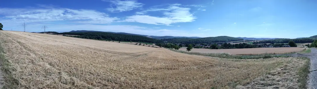
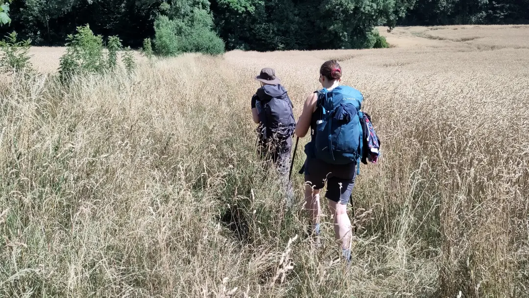
We neither heard any knocking nor found people standing at our bedside in the night, so we were able to sleep peacefully. Somewhat refreshed, we headed into the next day. Out of the village and into the meadows and fields. The landscape was characterized by hills with mown meadows. Perfect for relaxed hiking; not necessarily blessed with spectacular views (though there were a few nice ones and at one point the trail even crosses the runway of a glider airfield).
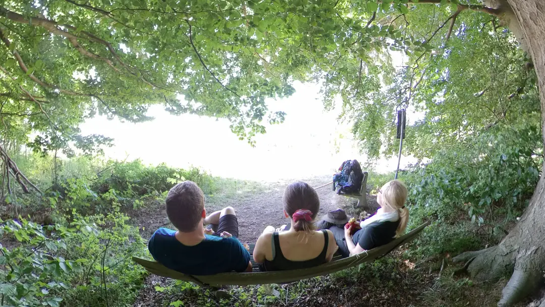
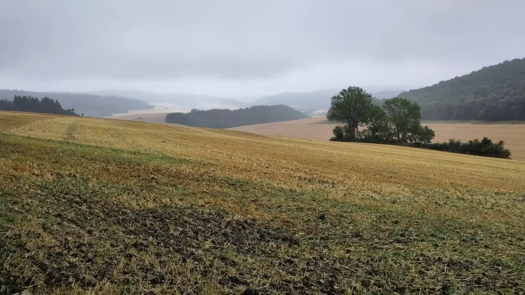
Initially, the hike was rather uneventful. Mostly in the forest, noticeably cooler than the day before — what could possibly go wrong? Well, a faint rumble in the distance hinted at what might be in store. Scorching heat the day before, thunderstorms this day.
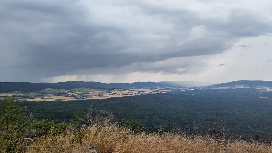
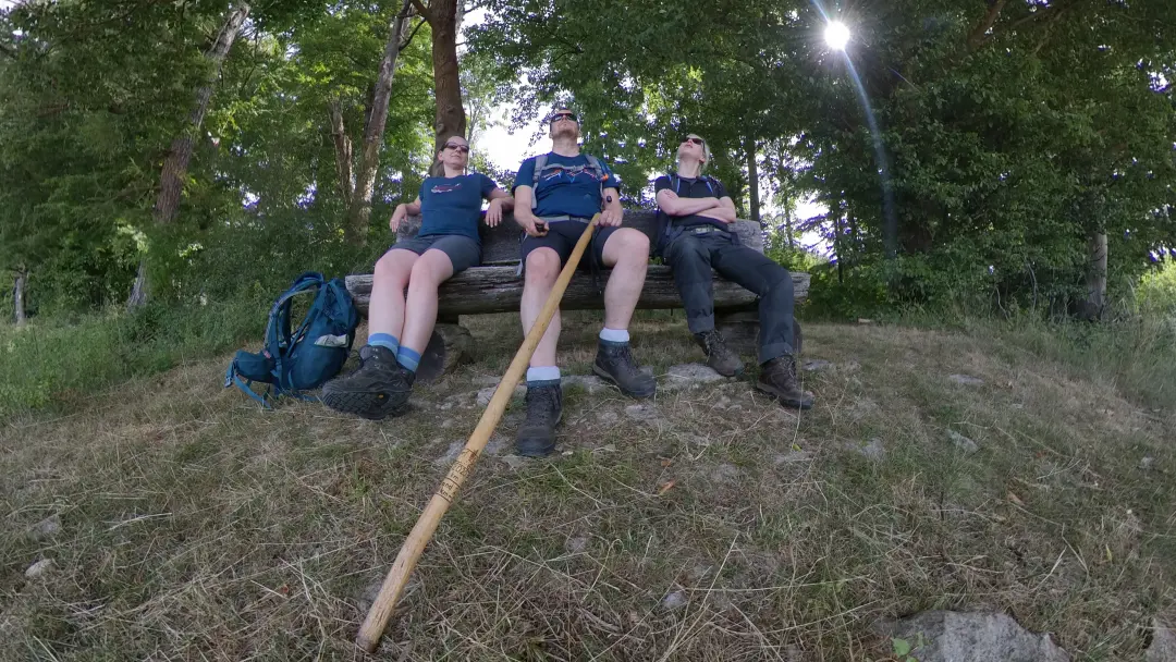
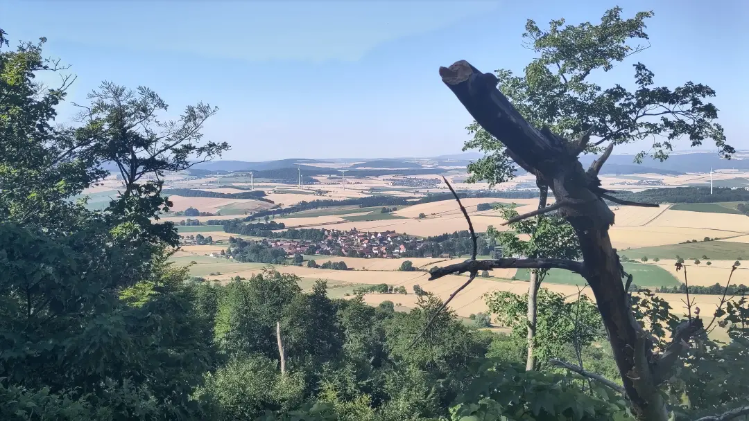
We were somewhat lucky, though, and reached a kind of shelter with a view (where this photo was taken). This gave us time to put on our rain gear and wait out the worst of it. Not much happened after that. The day ended with a light drizzle as we descended the hill and headed to the hotel for a quiet evening.
Day 6 - Back to the Start
The last day of the hike led us back to the starting point in Alfeld. Right at the beginning, someone apparently wanted to lure us into the forest by laying out a trail of pretzels:
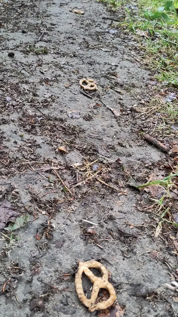
We didn’t find the pretzels — soaked with rain and mud — particularly appetizing and decided to continue the hike through the forest and fields instead. Like the previous day, the weather was rather damp and misty, which, after the heat battle of the days before, was a very welcome change. Besides, even this kind of weather can offer some lovely views.
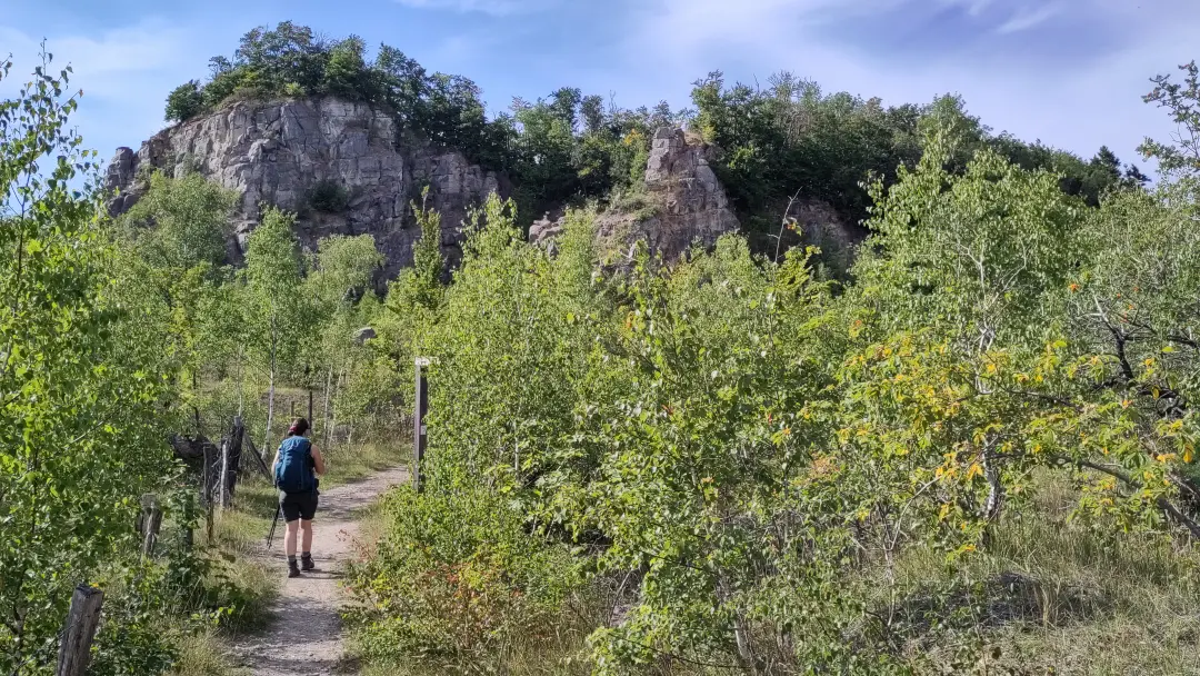
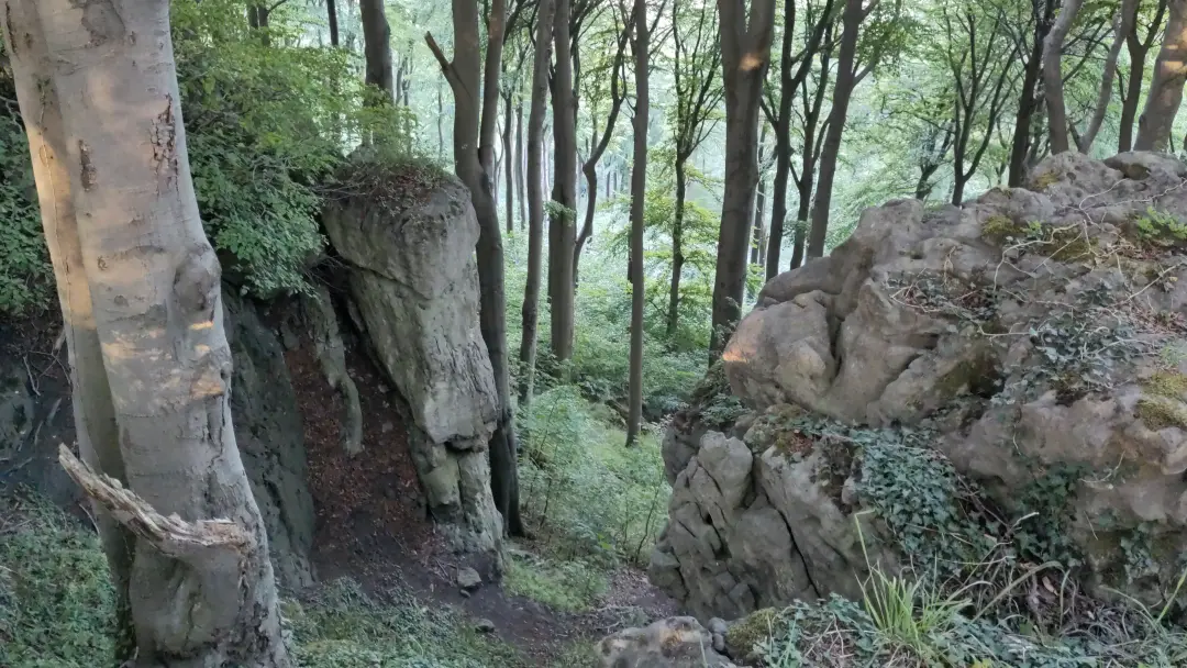
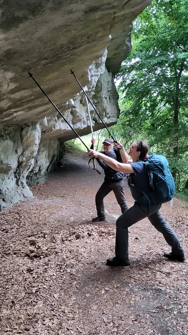
The trail made one final loop along the ridge with its karst cliffs. This time, however, it followed paths beneath the cliffs rather than along the ridge, offering a different perspective and prompting the ladies to show signs of megalomania. A rock overhang is, of course, constantly at risk of collapsing. Clearly, someone had to do something about that...
The rest of the trail that day was fairly unspectacular (as evidenced by the lack of photos). You just walk along, chat, admire the scenery, and suddenly stumble into Alfeld. We were genuinely surprised when we found ourselves back on the path we had left the town on a few days earlier. One of those classic “Oh, we’re here already!” moments. Lütti was picked up immediately, as she needed to head home that same day. We headed to the hotel, and just like that, the day was over. A delicious dinner at the hotel wrapped things up, and we expected a quiet night before taking the train back to Ilmenau the next day. Unfortunately, the hotel’s technology had other plans...
At 2 a.m., we were jolted awake by a smoke alarm. A first for us, but thanks to numerous workplace drills, we were prepared: out of bed, clothes and shoes on, grabbed our already packed backpacks (yes, you’re not supposed to take them, but since they were ready to go, we figured it was fine), and headed outside. The first surprise in the hotel parking lot (well, not really a surprise): 12 cars in the lot, 12 people outside, and some of them were couples or hadn’t driven. In other words, a significant number of guests had decided to just keep sleeping. Second surprise: no one had called the fire department. Since there was no visible fire, we held off as well and called the hotel owner instead. The conversation was... remarkable:
Manu: "The fire alarm is going off in the hotel. We can’t see any fire."Hotelier: "Is it all the alarms or just one?"
Manu: "Seems like just one."
Hotelier: "Probably a false alarm. Hm, can you turn it off?"
Manu: "Uh... No?"
Hotelier (slightly annoyed): "Alright, I’m coming."
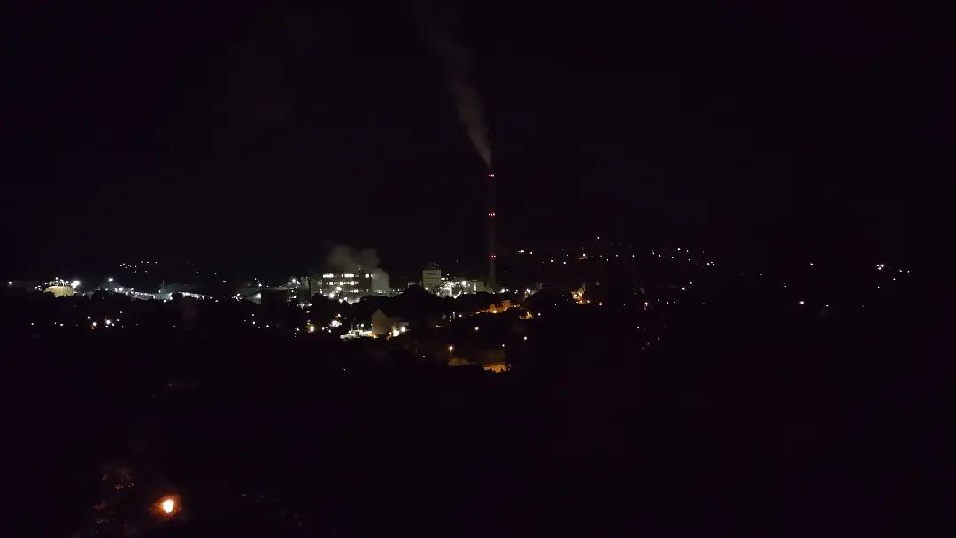
He arrived, ripped the smoke detector (along with part of the wallpaper) off the ceiling, and went back home. We (and the other guests who had gotten up) went back to bed. Apparently, there wasn’t a fire. At least we got an unexpected photo of nighttime Alfeld:
Last Day & Return Journey
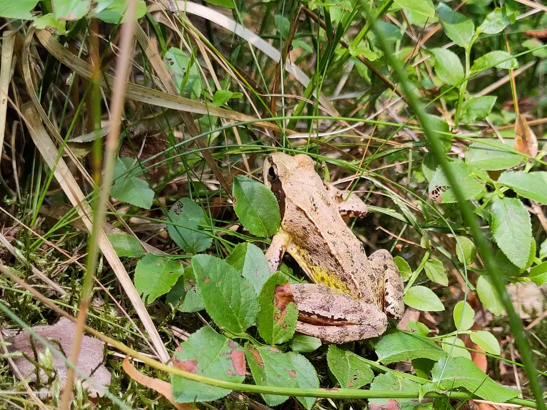
The last day wasn’t really a hiking day anymore, but was mainly defined by the train ride home. Since the Ith-Hils Trail is just under 100 km long, we had planned from the start to walk the 5 km from the train station back home. The 5 km helped stretch out the muscles a bit, but were relatively uneventful. We did spot a nice little frog in the forest, though:
So, what’s the takeaway from this hike? 38°C is definitely beyond our comfort zone. Long-distance hikes should probably be saved for the spring or autumn (which we’ve done every year since). The Weser Uplands is a lovely area, though not quite as spectacular as the Harz or Northern England (though that hike was also significantly longer, and therefore more varied). And sometimes, you meet nice people through Internet forums, who will then provide food on a hike when the hotel doesn’t have any. That’s nice too...